June 3 - 10, 2020:
Here I go again and for some reason I’m nervous about it this year, I’m feeling more vulnerable, older and slower. I always wished I had that reckless, devil may care gene, but it just isn’t there. It’s June 3rd and after checking and rechecking all my trip checklists finally I’m off. The first days target is a BLM dispearsed campsite near Sedona which I thought would be easy as I had been there a few years ago and liked it Guess what, I rode around for an hour looking for it, couldn’t find it and settled for another good spot which I later found to be within 1/4 mile of the desired location. I think that black man at the Walmart where I had stopped for a few food items near Phoenix, wandering down aisles saying “I can’t breathe” over and over messed with my brain.
 |
| Rest stop north of Phoenix |
It was really hot 100 +, that also helped, and my spirits soared when I plugged in my new 12V fan and it worked beautifully. The Refrigerator was really put to the test and was struggling, but it kept going, although it worries me.
Day 2 was an intended hike on the nearby Bell Trail, but unknowingly I started from the overflow parking lot which meant a extra 1 1/2 mile walk to just get to the Bell Trail. It was extremely hot and I was wondering why people on the trail were dressed more for the beach trip than for a hike. It turns out, the Bruce Drockett Trail, leading to the Bell Trail is mostly downhill to a flowing river oasis with several water ponds which everyone but me knew about. As it already about 100 degrees and I would have to walk uphill to the parking lot, that was enough of a hike for me. Sedona itself leaves me cold, such a beautiful spot that has been filled with excessive and often gaudy development, I’ll just leave it at that. I departed Sedona on scenic route 89A heading towards Flagstaff. Many people were stopping along the river to wade and cool off, but parking spots were limited. I had researched a couple of dispersed BLM and Forest Service camping area off route 89A and ended in one for the night.
 |
| Warning sign at trailhead didn't put me at ease |
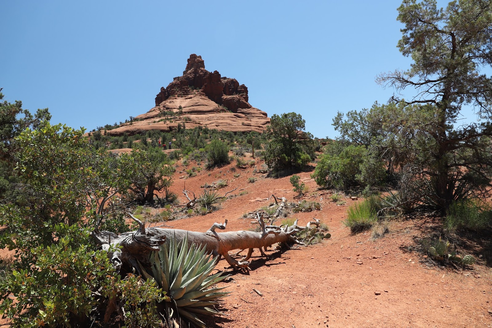 |
| Bell Mountain view |
 |
| Lots of room and real trees |
Day 4 I headed north on Rt 180 with a planned stop at “Red Mountain” which exceeded all expectations. It was written up in Arizona Highways otherwise I would have driven past as most travelers heading to the Grand Canyon do. I then continued on to the Grand Canyon south rim which has just reopened, partially, so it’s not as jammed packed as it normally would be. I saw little social distancing or mask wearing among the tourists, which ,makes me wear my mask even more. It was very windy with lots of dust blowing so the mask was giving me some extra protection. I wandered around the “Mather Point” rim area which I had missed on our previous limited trip two years ago. I did more research and found that there are several National Forest road areas open for dispersed camping just south of the National Park. It was even cooler here at night, had to get into my sleeping bag in the early morning hours.
 |
| Red Mountain was definitely worthwhile |
 |
| Another view |
Unbeknownst to me, (there were no earlier road signs) the road is closed at Lipan Point and no traffic is permitted into the Indian country due to the very serious covid-19 virus issues on the Indian reservation. As a result, I had to turn around and backtrack back to Flagstaff, there is no alternate way. At Flagstaff, I decided to go to the Cinder Hills OHV Area adjacent to the Sunset Crater Volcano National Monument for the night.
 |
| The warning sign on the bright Angel Trail |
 |
| View from the trail into the canyon |
 |
| Lipan Point overlook view with the Colorado River far below |
 |
| Another view into the canyon |
 |
| The OHV area is huge with both flats and hilly forested areas |
 |
| The OHV road heading towards Sunset Crater Volcano |
 |
| View from the Lava's edge trail, the lava looks so fresh |
 |
| View of the Sunset Crater Cone |
 |
| These murals were very well done, almost fine art |
 |
| No vendors, but the views were great |
 |
| Colorful flags |
 |
| I was quite impressed by this mural and the background |
 |
| A surprisingly good shot of Horseshoe Bend considering the poor light |
 |
| Hanging Gardens was not so exciting, the walk to it was way better |
 |
| The Chains area is a slick rock area open for fishing, swimming and rock scrambling |
 |
| Many impressive sights in all directions |
 |
| Lone Rock view |
After exiting Lone Rock, I saw a side road leading to a cattle gate. I had expected a "No Trespassing" sign, but was surprised instead to see "Please close gate behind you". The rock formations were incredible and there was a deep slot canyon running under the highway bridge. I actually got into the slot, but shortly ran into a dead end or I should say an obstacle beyond my capabilities.
 |
| This was the main attraction |
 |
| This is about where I stopped |
 |
| The main attraction |
 |
| In every direction it is equally impressive |
 |
| It's kind of like this in all directions ! |
Next stop is Grand Canyon North.


