July 17 - 21, 2022:
I depart Price, UT, on Sunday morning heading southeast on route 101 to I-70 east with the Book Cliff Mountains in the distance which the locals call the “Books”. I’ve travelled this area twice in the past week and am remembering some of the landmarks.
As I approach a highway exit close to the Colorado border I see a sign for Cisco, Utah and the Buzzards Belly General Store and make a quick exit. This road shows on my map as highway 128, which travels along the Colorado River back to Moab, UT. I had traveled this route and camped along it a week ago closer to Moab. As I am driving to Cisco, I notice an Amtrak passenger train running on the adjacent track, I thought that odd, not realizing how close to Moab I actually was. I then come upon the ruins of Cisco with lots of empty lots, old house debris littered all about and art work adorning the side of one wrecked building. There are signs of habitation, various odd art pieces, the old post office building and the Buzzards Belly General Store. I had just stumbled upon this ghost like town, had no idea it existed. I later learned that it has become quite a tourist attraction. I went into the General Store to look around, they had lots of unique artistic tee shirts, lots of fishing supplies, various objects of art and associated oddities for sale. A latter on line search tells the story, how a woman, Eileen Muza, on vacation learned of this ghost town, visited it, bought it, moved in and has been bringing the town slowly back to life.
https://roadtrippers.com/magazine/cisco-ghost-town-utah/
 |
| Many Cisco buildings are adorned with some form of art |
 |
| Cisco entrance sign in front of theBuzzards Belly General Store |
 |
| The Buzzards Belly Store |
I then continue on to Grand Junction, Colorado making only one unplanned stop at a dinosaur fossil trailhead near the highway to check it out. It’s simply too hot for this now at mid day, maybe something for latter ? At Grand Junction, I fine my way to Main Street, park and walk around the central business area. Most of the businesses are closed, it’s Sunday, but it looks like a good place to wander or shop on Monday. I have been here before, I distinctly remember the sculpture of James Dalton Trumbo sitting in his bath tub in front of the Avalon Theater. This is a very nice Main Street, it has everything covered; antiques, art, sporting goods, restaurants, bars, music venues etc. I’m really annoyed that the Cowboy Junkies were playing yesterday at the Avalon Theater and I missed it.
https://en.wikipedia.org/wiki/Grand_Junction,_Colorado
 |
| It's good to see working artists |
 |
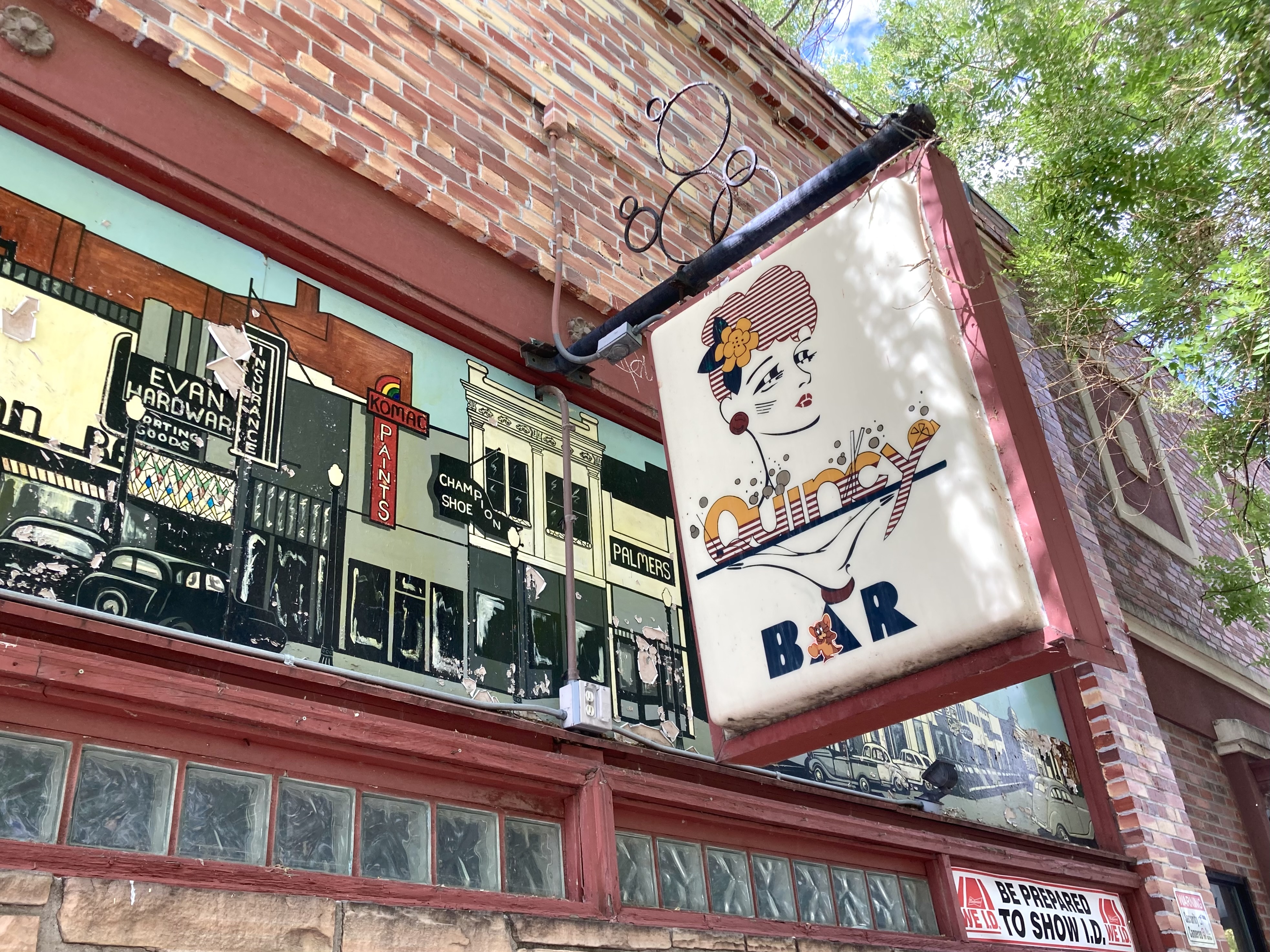
| Great facade of the Quincy Bar, unfortunately it wasn't open |
 |
James Dalton Trumbo
|
 |
| Another interesting sculpture |
 |
The friendly owner told me this sculpture is called "The Stretch"
|
 |
| You might be getting the point, Grand Junction is an artsy progressive town |
I return to the Main Street area the next morning, visit a couple of shops but I”m not in a buying mood. I do go into the excellent Main Street Bagels Artisan Bakery and Cafe and get a delicious poppy seed bagel and an iced tea. I also found my way to the River Front Trail, not so impressive in the area I saw, but I may have been to a poor area. There was art activity, more like graffiti, on the bridge abutments that were colorful, but somewhat trashy. The area looks more like a homeless jungle than a park area in this area. To set the record straight, this city River Park is extensive and is very nice in most other areas. The Colorado River is flowing strong, I was told that they have received considerable rain in the past week. Actually Grand Junction derives its name from being at the junction of the Colorado River and the Gunnison River.
 |
| So much more than hot Bagels |
 |
| Don't mind waiting in line here |
 |
| Highway Bridge view |
 |
| Colorado river |
I stopped at the Grand Junction Train Depot which I found somewhat confusing as there appeared to be three of them all in a row. Actually there is the old original Denver and Rio Grande Depot built in 1906, now closed, but with a civic group trying to raise funds for a restoration. Looking into a window on the locked door I see a beautiful glass panel of the original railroad logo. This Depot was replaced in 1992 by a former restaurant building that is a shadow of the former Depot. The confusion is about the other large building with a large sign saying Union Station, this turns out to be a former restaurant, was never the train depot, just looks like one. Amtrak train service continues to be served here by the California Zephyr which runs once daily between Chicago and Emeryville, California.
 |
| The original Depot |
 |
| Needs much restoration, but lucky to be still standing |
Day 3 takes me to the Colorado National Monument a few miles outside of town, I’m not sure why this isn’t a National Park, it's really great. It is far less crowded than other parks, doesn’t have quite the star power of the biggies but the terrain and views are superb. I especially like the Ute Canyon area on the side of the park closest to Grand Junction. The park spans the mountainous terrain between the cities of Fruita and Grand Junction with an entrance on both ends. I did a short hike at the visitors center and and a few roadside pullouts, but it's too hot for a long hike.
https://en.wikipedia.org/wiki/Colorado_National_Monument
 |
| View from the entrance road |
 |
| Many viewpoint along the road like this |
 |
| John Otto was responsible for it becoming a park |
 |
| This entire area was once Ute tribal territory |
 |
| Many towering rock pinnacles down in the valley |
 |
| Shear rock walls along the road |
 |
| Many views down into the Ute Canyon |
 |
| The park was the work of the CCC |
 |
| I really wanted to hike down to the bottom, but no easy, short trail |
I the evening, I go to a downtown Grand Junction Brewery hoping for a music jam session, but there was nothing going on. I had one lousy beer, a nice place, but not to my liking. So, I went down the street to the "Feisty Pint" inside the old St. Regis Hotel which is more like a neighborhood bar where you can get something at least palatable like a genuine Budweiser.
It's another hot night and I leave my rear and side doors open until almost midnight at Walmart, rather scary, but no issues. I’ve decided that tomorrow I will leave Grand Junction and head anywhere at a higher elevation where the temperatures might be more comfortable.
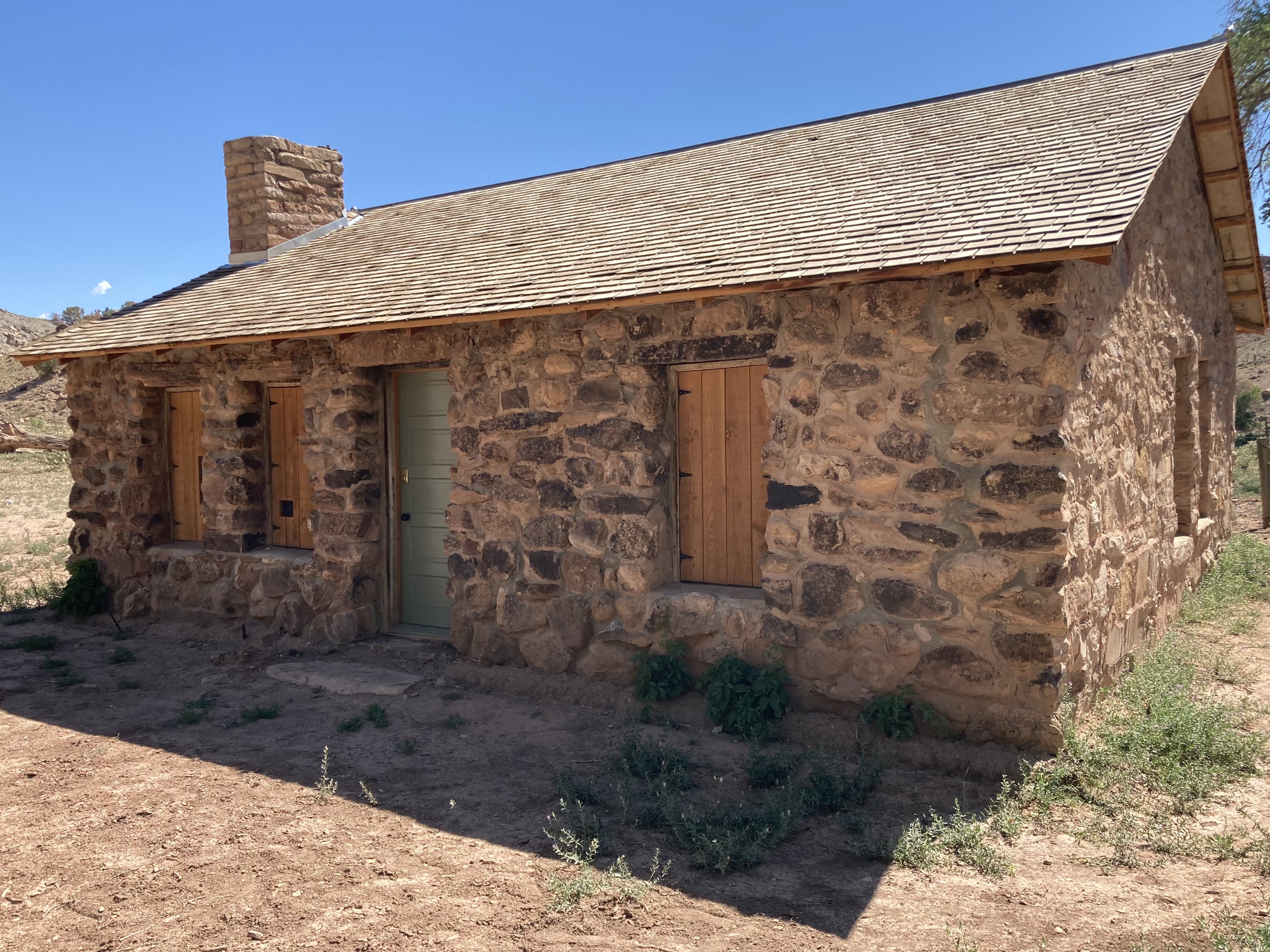
It’s now Wednesday morning as I leave Grand Junction heading east on Route 50. I come upon a roadside historic sign for the Escalante expedition which came through this area and then a few miles further an exit for The Escalante State Wildlife Area. I take the exit which puts me on an unpaved county road heading 3 miles to the Gunnison River and then another 6 miles to a historic settlers cabin that has been saved. The road passes through a huge farm and ranch, 1,000’s of acres and in areas the road gets narrow and climbs up into wild mountainous terrain with huge rocks barely clinging to the steep slopes overhead. I would not want to be here during a storm. The cabin was built by early settler Henry A Smith who had a colorful life to say the least, involving the Sheep War of 1916, see sign below.
 |
| The Gunnison River |
 |
| Alfalfa field |
 |
| Captain Henry A Smith cabin |
 |
| Continuing uphill |
 |
| Loose rocks on steep slope hanging over the road |
 |
| This canyon was the site of the Sheep War in 1916 |
I survive that adventure without incident and continue on to the town of Delta, Colorado. I see a sign claiming Delta as the city of murals and instantly remember coming through here two years ago, and it has a beautiful downtown, much nice architecture, especially the Egyptian Theater, many well impressive murals and an auto sales business with many 1930-1950’s antique cars for sale. Three of my favorite subjects in one town is pretty unique. Unfortunately the locals here have also elected one of the nastiest women in the US House of Representatives, Lauren Boebert.
 |
| Great artistic mural |
 |
| Lots of agriculture around the Delta area |
 |
| We smoke everything according to the sign, but now for sale |
 |
| The Egyptian Theater |
 |
| A different view |
 |
| These vehicles were blasted to imitate a natural weathered patina (tacky) |
 |
| Nice straight sheet metal front |
 |
| Another great mural |
I see signs for Fort Uncompahgre which has been recreated on the edge of town, on the original old Spanish Trail. The fort was established back when this area was part of Mexico (hard to believe) in 1828 by a Frenchman Antoine Robidoux as a fur trading post with the local Ute Indian tribe.
https://en.wikipedia.org/wiki/Fort_Uncompahgre
My travel plan has become annoying as every direction takes me to a place I have been to before, something I have been trying to avoid. However there is one place, Crested Butte, Colorado, where I stayed for one overnight about 20 years ago that I'd like to revisit. It also involves a scenic drive over Kebler Pass that should be beautiful. It's decided, tomorrow, I will head north on routes 92 and 133 to the Kebler Pass Road and on to Crested Butte, Colorado.
The next morning when traveling on route 133 when I come upon the town of Paonia, CO that I remember visiting two years ago. I thought it was one of the most interesting, attractive and liberal towns in my travels at the time. I revisit the Main Street area, take a few photos and it's as good as I remember. I was tempted to stay there for the day, but I'm focused more on getting to Crested Butte, Colorado.
https://en.wikipedia.org/wiki/Paonia,_Colorado
 |
| Garden shop |
 |
| Nice murals |
 |
| Linda"s Bistro looks interesting |
 |
| Much art in town |
 |
| Beautiful tin facade |
 |
| Big 4 Tractors are a favorite |
 |
| Very artistic creation from an aircraft parts |
I come to the exit for the Kebler Pass Road which goes for about 40 miles up over the Kebler Pass on a mostly smooth unpaved surface. It is so lush and green with many beautiful Aspen tree groves. This area is known for its beautiful spring wildflowers and many are still in bloom, spring comes late here, although the peak is over. The very popular Crested Butte wildflower festival just ended a week or two ago. There is quite a lot of road traffic and everyone has to drive so fast creating huge clouds of dust. Many people who drive these roads appear to have no interest in the beautiful scenery, trees or foliage, but delight only in driving as fast as possible. I am pulling over often to let them race down the road. I wish I could get a jet engine on the rear of the van to blast these people with dust as they pull up behind me with the flick of a switch !
https://www.uncovercolorado.com/scenic-drives/kebler-pass/
 |
| I stopped to cool off for a few minutes in the cold crystal clear water |
 |
| The road seemed to skirt around the peak in the distance |
 |
| Through dense stands of trees and greenery |
 |
| Wildflowers and mountain views |
 |
| Miles and miles of curvy road |
 |
| I stop to admire the Aspens |
 |
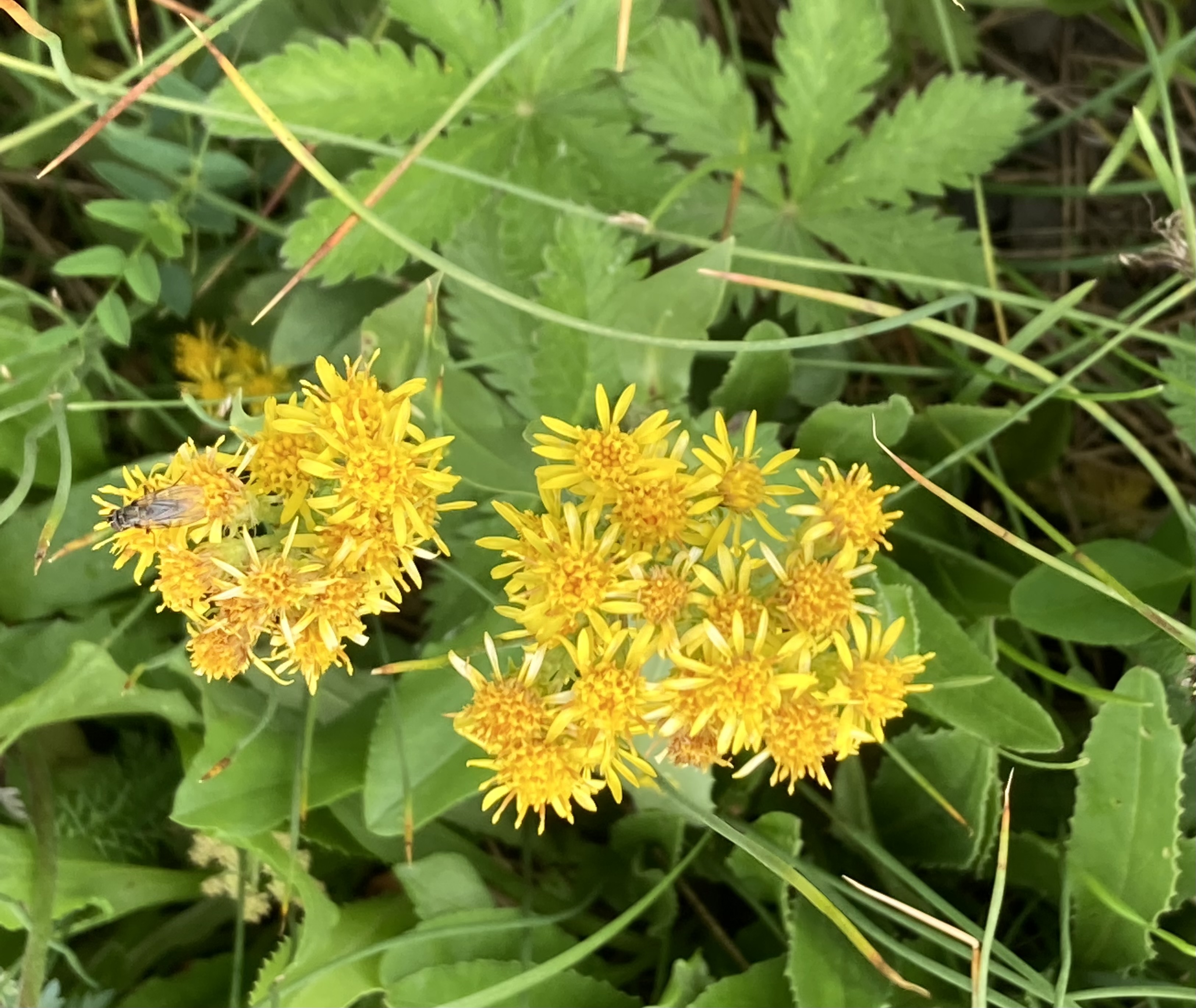
| Many wildflowers still in bloom |
 |
| Cow Parsnip is beautiful but is poisonous, do not touch |
 |
| Eventually back onto pavement nearing Crested Butte |
Once in Crested Butte, I am surprised at the crowds in the downtown area and the difficulty parking anywhere. I don’t remember this congestion from my previous visit, I guess that’s good, something new ! The odd thing is that there is almost no street parking anywhere, town residents mostly park on their front lawns, not on the street. It’s very touristy downtown, all stores, restaurants, bars but it is attractive with many old original buildings. The entire downtown area is a designated National Historic District and they have retained the old western flavor. They have plaques on the buildings giving their history, although I think I am the only one that I am reading them. I walk many circuits up and down Main street, but find no live music or anything very interesting in the bars or on the streets. I end up overnighting in the van where I parked it, since I see no signs there prohibiting it.
https://en.wikipedia.org/wiki/Crested_Butte,_Colorado
 |
| The old Bank now serves Local Coffee and Global Tea |
 |
| The old City Hall built in 1883 remains |
 |
| I do believe that Butch Cassidy was everywhere |
 |
| Beautiful store window display |
 |
| This buildings paint really stood out |
 |
| Nice storefronts in varying colors, very nice |
 |
| I did find the bench interesting |
 |
| The history of this building was remarkable |
I leave Crested Butte in the morning heading southwest for Gunnison, CO. I don’t remember much about Gunnison, but I'm quite sure I have passed through it before. Once there I’ll pick another destination heading in the general direction of Tucson, AZ as my travel allowance is now running low.