August 20 - 26, 2017:
We leave McLain State Park about 8 AM, one of our earliest starts as we want to be at our destination by noon in hopes of finding an open first come / first seved campsite at Bay Furnace Campground in Christmas, Michigan near the Pictured Rocks National Lakeshore. It’s closer to 9 AM by the time we really get on the road after using the dump station, getting gas and hooking up the Jeep. We like to live dangerously !
The driving conditions are great and it’s about 150 miles on routes 41 and 28 to the campground. The trip is mostly through the forest passing through several small towns, the Chippewa Indian reservation and Marquette, Michigan. The highway then becomes more scenic as it hugs the shoreline of Lake Superior.
Our lucky streak stands for as we are riding around the campground and every site is either reserved or is occupied, we see someone getting ready to pull out of a non-reservable site. They pull out within a couple of minutes and we back right in, perfect timing ! It’s a nice campsite but not as open to the sun for my solar panels as I would like. As we use virtually no electric and can run the generator it’s not an issue.
The Bay Furnace Campground is in Hiawatha National Forest, has no hookups, but there is water and a dump station. It fronts onto the South Bay of Lake Superior and is the site of an historic pig iron blast furnace. The blast furnace was larger that expected and has been partially restored. All along the beach adjacent to the furnace are chunks Slag, (it looks like colored glass) a waste product of the furnace process that was dumped along the lakeshore.
 |
| The Bay furnace |
 |
| The South Bay shoreline at the campground |
The small town of Christmas, Michigan has the Kewadin Casino operated by the Sault tribe of the Chippewa Indians. There are several small tourist shops in town with Christmas related signs, a jam packed junk/antique shop, a hotel and a couple of decent bar/restaurants. It is located 5 miles from the larger town of Munising, Michigan.
 |
The Kewadin Casino with Santa out front and a Christmas
decor inside did put us in the mood and I came out a few
dollars ahead |
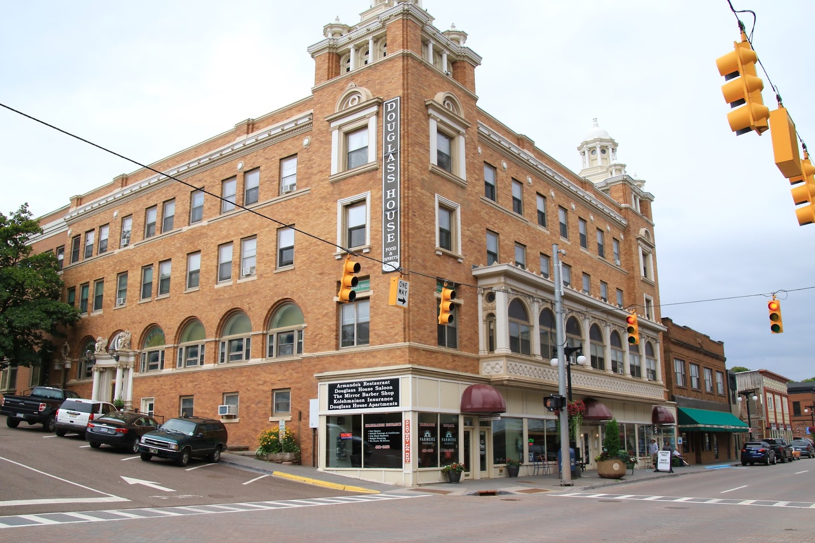
Munising is a full service tourist hot spot where you can find about anything you need. In spite of that it still retains an old seaport character and charm. Munising is situated on the South Bay of Lake Superior with a harbor offering scenic cruises, many restaurants and lodging possibilities and is the gateway to the Pictured Rocks National Lakeshore. The Pictured Rocks National Lakeshore became the first national lakeshore area designated in 1966. The area is famous for its colorful rocky cliffs, waterfalls and lighthouses.
 |
| A Munising welcome sign |
 |
| Street view |
 |
| Harbor view, to the right is a new modern harbor area under construction |
 |
Old street scenes are displayed around town
|
 |
| Also many classic painting on display |
 |
| The Pictured Rocks Interpretive Center was great |
 |
| There seems to be much pride in being a Yooper |
 |
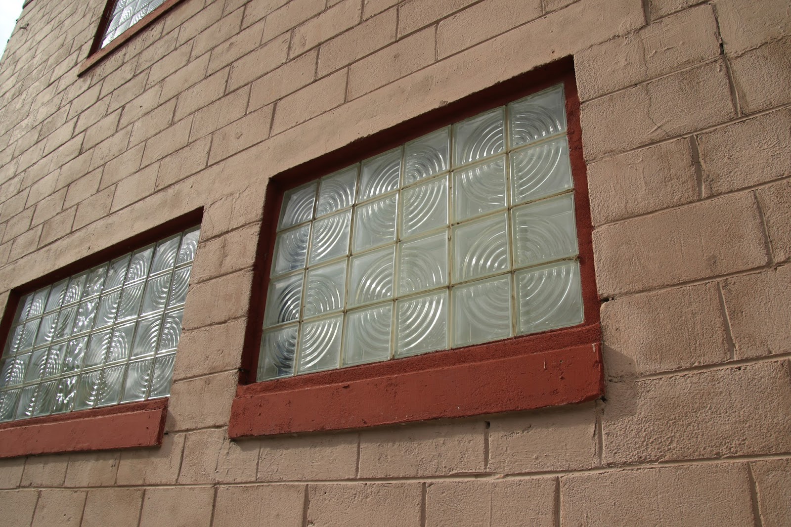
As I was taking this photo of these unique windows a woman
coming out of the store looked sort of weird at me and then said,
I've walked by this spot a hundred times and never noticed those
very interesting windows before, Thanks for bringing them to my attention. |
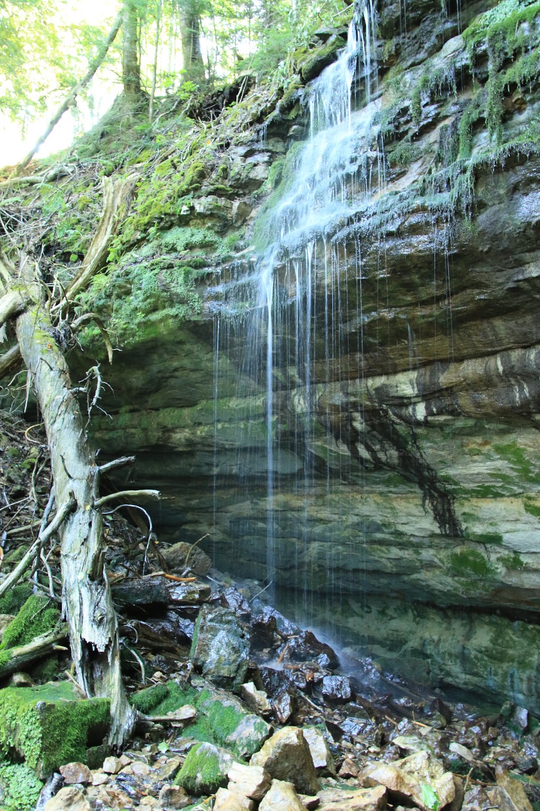
We begin with a short hike to the Munising Falls a few miles outside of town. It's way more interesting than this photo shows.
There is much hiking here, plenty of options, and we start with a hike from Sand Point to Miners Castle. It is a 4.9 mile hike and is a muddy trek through the forest most of the way. We actually decide to turn around after about 3 1/2 miles, short of the Castle, but in spite of the mud it was an interesting hike. The forest along this area of the lakeshore doesn’t look very healthy, most of the paper birch trees are dead and have fallen, the only trees that really look healthy are the white cedars. However, mushrooms, ferns and lichens are plentiful and doing well and there is water flowing everywhere. We later find that it has been an unusually wet year which explains why the trail is so wet and muddy.
 |
| In some areas there was a boardwalk |
 |
| In other areas just mud and water |
 |
| A small bubbling waterfall along the trail |
 |
| Lots of decaying birch and ferns |
 |
| Also mushrooms and lichens |
 |
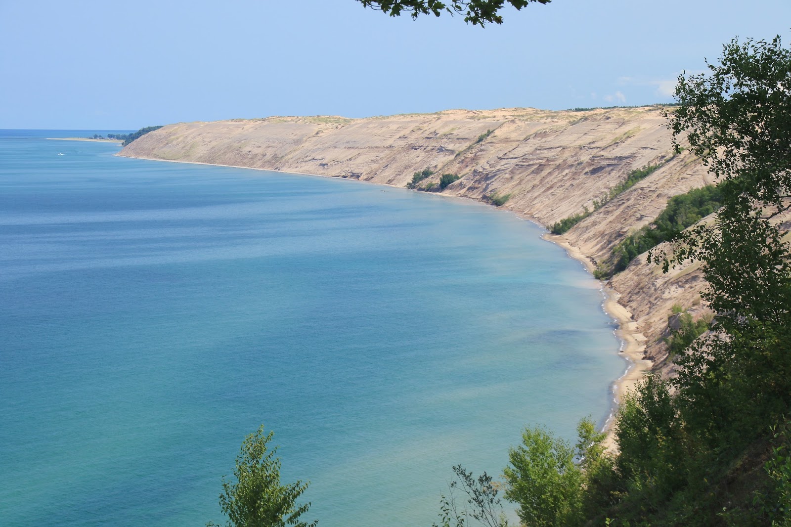
A few openings in the trees to the beautiful
aqua blue water of Lake Superior |
Later back at the Sand Point parking lot, we run into a young couple we had passed on the trail. It turns out that they had hiked from Miners Castle to Sand Hill, intending to hike back, as their car was parked there, but they were out of water and there was none available at Sand Hill. They also didn’t really want to hike back, so we offered them a ride as we had planned to go there anyway. At Miners Castle there is a short trail to upper and a lower observation decks with a view of the Miners Castle sandstone formation. It was named by a mining party looking for minerals who thought it looked like a castle and surprisingly, it really does. We are done for the day after about 23,000 steps slogging through way to much mud. Hours later, while stopped at a traffic light in Munising, the couple crossed the street in front of us, how ironic !
 |
| View of Miners Castle from overlook trail |
 |
Looking down on Miners Rock with a Pictured Rocks cruise
boat going past |
It rained heavily during the night and is very cloudy in the morning as I head to the very popular coffee shop in Munising called the “Falling Rock Cafe and Bookstore”. It is a good coffee shop with good eats, an ice cream counter, a bookstore and gift shop, a wining combination. It also has many tables, working WiFi and live music a couple of times during the week. On Wednesday evening a group of about eight locals play mostly old seafaring songs and sound very good.
 |
| This seemed to be everyones favorite place in town |
Our second hike is to Miners Falls which is a waterfall accessed by a .6 mile trail. It seems as if everyone has decided to do this hike today, it is super crowded and there is a waiting line to get onto the falls viewing areas. It is a great view and you don’t have to work hard for it. I suggested to Twinkles that they should reroute this trail to make it considerably longer to cut down the traffic. I’m only have serious, but some of these areas are sort of being loved to death.
 |
| Miners Falls |
We then go to nearby Miners Beach where the beach views are excellent as the wind has whipped up sizable waves on the lake and the sky is much clearer. It is bright sun by now, but the strong wind blowing over the average 40 degree lake makes it feel like an arctic blast which sends us back to the Jeep for our jackets. The view was worth it !
 |
| Miners Beach was a good place to chill out, what a view ! |
 |
| The stairway to the beach |
Our next hike is from the trailhead at the end of Chapel Road to Mosquito Falls and then on to Mosquito Beach. This is another popular trail and very crowded as the beach area is very scenic. The viewpoints for Mosquito Falls were not so good although Mosquito Falls is a great waterfall. We see this often on trails and roadside scenic viewpoints where trees or brush have grown up which almost totally blocks the view. Usually the trees could easily be trimmed or removed, they are not 1,000 year old giant sequoias. More amazing to me was of the quantity and variety of mushrooms along this trail. In fact I am thinking that the waterfalls and lighthouses are overrated, the mushrooms are equally impressive here. At trails end, there was no beach access as the 5 -6 foot waves were pounding right against the cliff walls. The prominent rock formation there, Chapel Rock, is amazing with a large tree growing out of it’s top but it was mostly obscured by the trees. It must be a gorgeous view on a calm day when you can view it from the beach.
 |
| Mosquito Falls |
 |
| The surf was ominous looking from the cliff edge |
 |
Chapel Rock must be seen from the beach or lake, but very
impressive from the overlook also. The tree growing on the
top is the most interesting part of it. |
 |
| A view along the lakeside |
 |
| Beautiful layers of colors in this fungus on a dead piece of wood |
 |
| The mushrooms were in all shapes and colors |
 |
| These reminded me of Reeses peanut butter cups |
 |
| Such a bright red, Tomatoes ? |
Our final hike was from the Log Slide Overlook to the the Au Sable Light Station. This area was heavily logged, as was everything here in the early 1900’s which is hard to imagine today. The way they moved the logs out of the forest was to push them over the edge down a log slide virtually straight downhill into the lake where they could be loaded onto ships or barges. These hillside are actually sand dunes hundreds of feet high. You can go down the sandy hillside here at the log slide fairly easily, but coming back uphill is a killer climb. There are serious sounding warning signs to that affect on the top, but we saw many going down.
 |
| The Log Slide from the top |
 |
| View from the trail of the Au Sable Light House in the distance |
 |
| The crystal clear rocky shore near the lighthouse |
 |
| Great place to pick rocks |
The hike traveled in close proximity to the lake with many viewpoints and additional log slides areas. In places the lake waves were within 20 feet or so and beautiful. After two miles we arrived at the Au Sable Lighthouse which is a beautiful 86 foot high structure that went into operation in 1874. We visited the lighthouse museum but passed on the lighthouse tour as we have done several already and it would have added about another two hours to our hike. There have been many ship wrecks along this coastline and Au Sable Point is particularly treacherous area.
 |
| The Au Sable Lighthouse and attached light keepers house |
 |
| A lake view looking towards the sand dunes |
On Tuesday evening there is a music event in the downtown Munising harbor park. There was a bluegrass band called the “Sparrow Tree Band” playing which were very entertaining, the turnout was good, there were dancing girls, both young and old and it was a beautiful evening.
 |
| The Sparrow Tree Band were entertaining |
We were concerned about our reservations for the Pictured Rocks cruise on Thursday afternoon since all cruises had been cancelled due to rough seas on Tuesday and Wednesday, but luckily the weather improved on Thursday and we made it. It was still about a 10-15 MPH wind blowing which makes for a cold wind over that 40 degree water, but we had a few layers of clothing and were fine. It was a 2 1/2 hour narrated cruise of about 30 miles along the Pictured Rocks Lakeshore to view the colorful rock cliffs and formations. The only way to really see the best of the pictured rocks is from the lake either taking the cruise or in a kayak. It was a beautiful cruise with equally good interesting narration, better that anticipated.
 |
| The boat cruise crowd looking a little tired on the return |
 |
| Miners Castle from the boat |
 |
| Bridal Veil Falls |
 |
| Kayakers in front of a colorful section, the colors come from minerals in the dripping water that runs down the cliff faces staining the rock |
 |
| Another very colorful area with large rocks that have fallen due to erosion |
 |
| There are many sea caves formed where softer rock has eroded away |
 |
| This is a sea cave that has eroded completely through forming an arch |
 |
A prominent rock face called Indian Head, you need to see the profile
to really see it |
 |
| The historic Grand Island East Channel Lighthouse, now abandoned |
We have enjoyed our week here, but need to move on, summer is fast coming to an end, it was 43 degrees this morning.
The next stop is Tahquamenon Falls State Park;
Twinkles and Slick