Tuesday, May 31, 2016

Tulelake, Lave Beds, Caves and the Modoc War

May 22 - 24, 2016:


We have had a string of erratic weather the past few days with alternating periods of sun and rain.  It continued today on our ride from Shastina Lake to Tionesta, California.  We took route 97 north through the small towns of Macdoel and Doris and the Butte Valley National Grassland.  I found reason to stop at each of them.  We then took route 161 east, which runs right on the Oregon border across the Lower Klamath National Wildlife Refuge.  At the town of Tulelake, another diversion for me, we continued south through the Tulelake National Wildlife Refuge to Tionesta where the Hawk’s Nest RV Park is located.  There were so many birds, duck, hawks, all manner of waterfowl along this route, it was quite an amazing ride.


A dreamy Lower Klamath Lake view driving across the wildlife refuge


My perception of Graffiti also


Stay solid brother, burn wood and have fun


The southern end of the Lava Beds National Monument is mostly lava tube caves.  There are approximately 20 caves of varying difficulty that you can go into.  These lava caves don’t have the spectacular limestone stalagmite and stalactite formations, but are interesting in their own way.  Twinkles is not keen on going into caves of any kind so she passed on this adventure.  Actually, I’m not so comfortable in them either and don’t quite get the attraction with caving.  I’m not a big fan of cold, damp, dark and dangerous places.  That didn’t stop me from going into a few of the easier caves, but no crawling for me these days !


A cave entrance, there are around 800 of them here,
which are old lava tubes running underground


Lots of large loose appearing rocks around these
caves make me nervous


Going down stairs into the darkness, flashlight don't fail me now !


Across bridges over deep, dark pits


Trying not to fall into the black holes


The rocks are beautiful


Cave sides were once hot dripping molten rock


I also did a hike amidst threatening rain clouds to the “Black Butte” cinder cone area and the “Thomas-Wright Battlefield.  Another sad chapter in American History involves the Modoc tribe that lived in the Tulelake and Lava country for thousands of years until the american settlers arrived. They were shortly removed from their ancestral land and sent to southern Oregon to a Klamath indian reservation.  This didn’t work out well, a band of the Modoc’s returned to their land, the US Army was called in and fighting broke out which became known as “The Modoc War”.  Eventually the Modoc’s were defeated, rounded up, their leader, Captain Jack was hanged and the tribe partially relocated to Oklahoma.


Beautiful flowers along the trail


Spectacular colors


A very colorful Lava vent at the Black Butte area


Remains of a volcanic vent


Our original plan was to move into the Lava Beds Monument campground for another day, but the campsites are really small and the other attractions we want to see are all on the northern end of the monument.  As result, we are moving 25 miles to the county fairgrounds in Tulelake.  We can also see more of the Wildlife refuge from there. 

The Tulelake-Butte Valley Fairgrounds in Tulelake, California were way nicer than expected and we have the place all to ourselves.  We are parked on lush green grass, don’t think we ever had that before, with full hookups for $18.  The downside is downtown Tulelake, mostly vacant old buildings although a couple are photogenic.  We looked for a gas station in Tulelake, there is none, only one old pump at a small store.  You have to drive north 8 miles into Oregon for a gas station, going south the road sign says no services for 70 next miles.  Tulelake is a large potato growing area, lots of Potato Harvesters and storage barns around town.


Most interesting abandoned Hotel building in Tulelake


Loved the artwork


Actually feel it says something about our country


Many grain elevators and potato storage cellars here


The level, green, irrigated fields seem almost endless


Our spacious campsite at the fairgrounds


We went into the northern entrance of Lava Beds National Monument and stopped at the “Petroglyph Point” area.  Tule Lake prior to the 1900’s practically covered the entire Klamath-Tulelake Basin.  In those days the native Modoc Indians traveled the lake in boats made from Tule reeds.  The present huge volcanic rock face was then an island in the lake.  The Modoc would come to the island and scrape designs and figures into the soft rock. They are thought to be of various ages but some may be as old as 6,000 years.


The fence is there to keep the idiots from defacing the history


There are thousands of birds living in this massive rock wall which used to be an
island in Tule Lake.  The ancient indians rowed their reed canoes here and carved
stuff in the rocks


No one knows what it all means ?


Most likely it means nothing


In the early 1900’s the US government started a reclamation project to build canals to drain Tule Lake.  The drained land was then cleared and converted into farm land.  The drained water in the canal system would be used for irragation and a lottery was established to provide this farm land to homesteaders.  The result was a much smaller lake, 1/6th of the original size, with a much reduced habitat for wildlife, but with much new farmland.  In order to offset the impact on wildlife habitat, a number of wildlife refuges were eventually established.


On the shore of the Tule Lake Wildlife Refuge


I did my part by stopping in time to save this
snake sunning in the middle of the road


There must be a trillion Red Winged Blackbirds here


Also Canada Geese and unusual White Pelicans


We continued into The National Monument to “Captain Jack’s Stronghold” and took the 2 mile loop hike.  Captain Jack and his tribe hid and fought the US troops from this very defensible position.  The area is riddled with lava tubes, boulders, caves and really good hiding places.  The US Army was really at a disadvantage here and it took them 5 months with a force 10-20 times greater that the Modoc’s to finally defeat them.  The trail was beautiful, can’t imagine a better trail through a Volcanic area except maybe a live flow in Hawaii ?


This wall was built by the US soldiers for protection


The Modoc's knew their way in here, knew all the good
defensive positions, attack positions and hiding places


A good observation spot with a Modoc shrine


Twinkles wanted to get in some sewing before we head back into the boondocks and I must leave for her to sew.  I could only find one bar open in Tulelake, Mike and Wanda’s Restaurant and Bar,  which looked like a real dive from the outside.  Surprisingly, kind of a nice decorating job inside and the shell casings lacquered into the bar top added a nice touch.  There were two locals in there having an interesting conversation, something about building a “Derby car” as in demolition derby and watching a classic movie on the TV.  They all seemed like friendly types and it was a good hour out on the town.

OK, enough of this Volcanic legacy tour stuff, now back into the forest.


Next stop is Chiloquin, Oregon. where we will hunker down for the Memorial Day weekend,
Twinkles and Slick 

Wednesday, May 25, 2016

It's weird in Weed, California

May 18- 21, 2016:


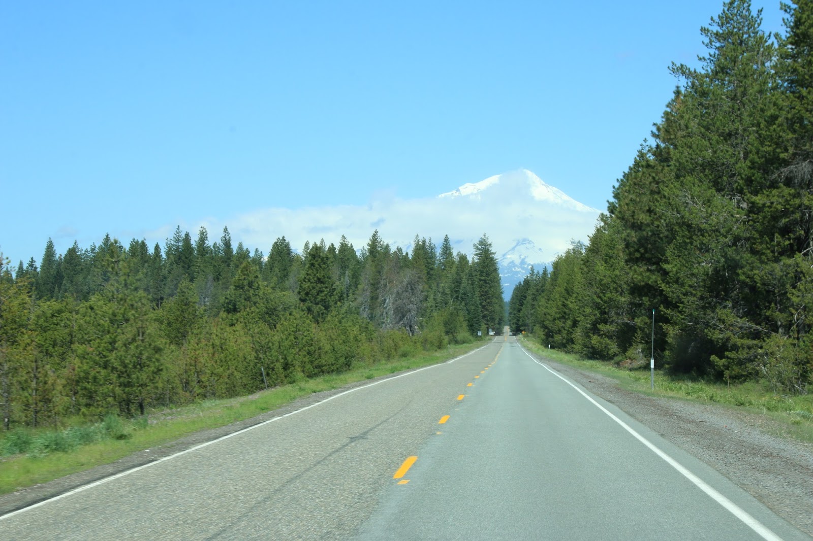
Our path today is Route 89 north through many miles of a burnt forest in the Lassen National Forest. Once out of the burnt area it is again dense green forest and then spectacular views of Mount Shasta.  There was a deer, probably hit by a logging truck that was spread all over the road, pretty nasty. I then saw another guy standing by his pickup truck on the side of the road, cell phone in hand, with heavy damage to his grille area.  This made me a bit nervous for the rest of the drive.  We get on route 5 at the town of Mt. Shasta and then it’s 10 miles to the exit for Weed, California.  Our destination, Lake Shastina, is about 5 miles outside of Weed which turned out to be easy to find.


Heading down the road towards Mt Shasta


Lake Shastina is a huge reservoir with boating and fishing access.  It is a primitive county campground, no hookups and is totally free.  The lake is fairly full at present, but in the past two years it has been practically dry during the summer due to water being diverted to other areas of California.  Shastina Mountain is the second highest volcanic cone of Mount Shasta.  There is a private golf community on the shores of the lake adjacent to the public access park.


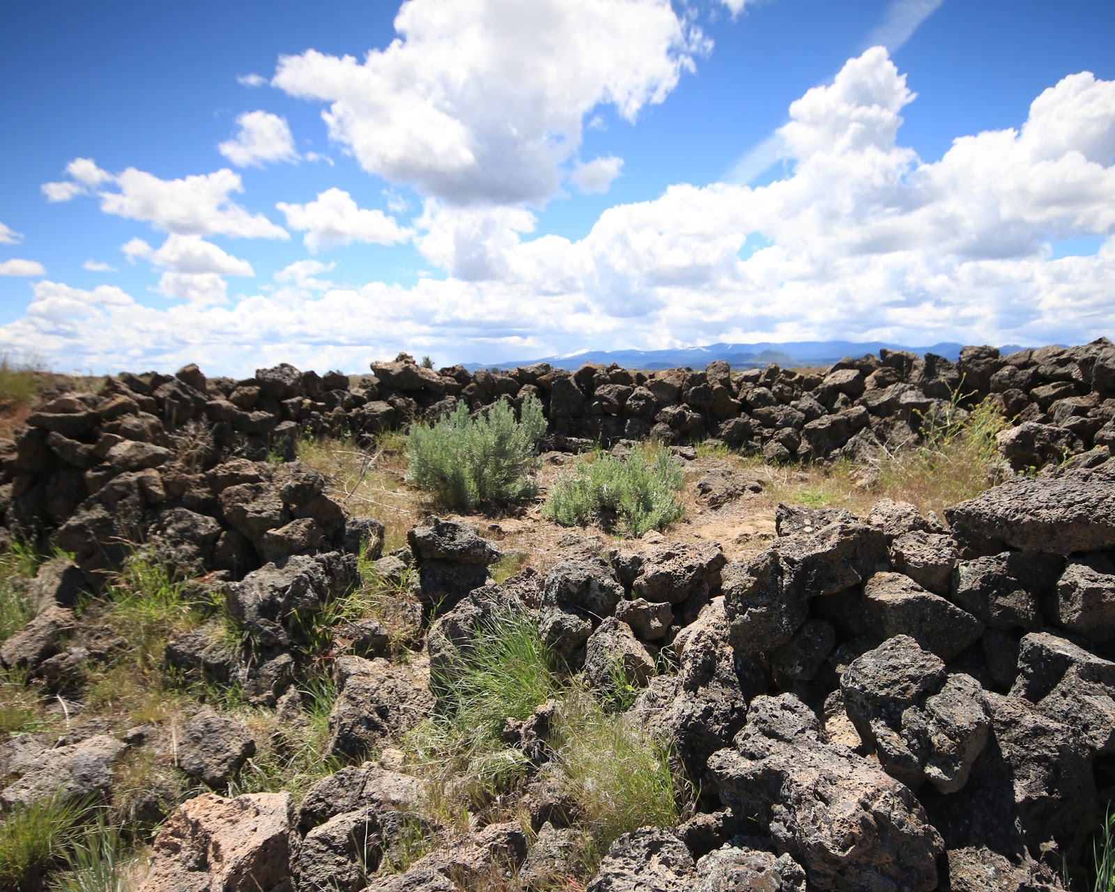
A island in the lake take is a nesting site for gulls


Like like it is fully inhabited


Morning view from the RV


In 1897, Abner Weed realiized that this location due to its constant wind condition on the face of Mt Shasta would be a great site for drying green lumber.  He therefore bought some land, built a lumber mill and a railroad to transport his lumber, then built  a bunkhouse, a warehouse, a cookhouse and a company town came to life.  In time other merchants started businesses and it became the town of Weed.


There remains a lumber mill in town


Abner is almost forgotten today, but his last name has become popular as it identifies with marijuana and has become a marketing and tourist draw for the city.  Most of the local businesses seem to incorporate a weed somehow into their advertising and most souvenir items are also weed related. It all seems a little sick to me ?


Get spaced out in Weed


Lumber still has a big precense here, there are lots of trees and one large lumber mill still remains in business.  It is common to see lumber trucks come through downtown and I believe about everyone here can use a chainsaw and heats with wood.


Following a lumber truck on Main Street


There is an excellent internet cafe and bakery, Ellie’s Espresso and Bakery, and we spent some time there, using their internet and they make a great Bears Claw.


The entry gate to Weed


Looks like an old theater, no movies these days


We also found the “Mt Shasta Brewing Company” and went for dinner at their “Ale House Bistro”.  Their entire promotional scheme has to do with Marijuana and their beer bottle caps even say “try legal weed”.  They have something called Brewglass night on Thursday evening with a group of local musicians playing 60-70’s classic music.  I really liked their restored old Divco dairy truck.


Sign on the Brewery building


It snowed on the surrounding mountains overnight and rained at the lake fairly steady.  The high temperature on Friday was about 50 degrees, but there were a few periods of sun.  We drove to the town of Mt Shasta, walked around the main street, it’s a more upscale town than Weed and is in close proximity to the Mt Shasta Ski area.   We then drove to the small town of Dunsmuir and did a short trail to the Hedge Creek Waterfall.


Mt Shasta is a stunning mountain


Of course John Muir liked it


I might join this Veteran's Club


The Hedge Creek Waterfall


Engine 1727 needs some attention


Nice paint scheme on caboose


It was then to the former lumber company town of McCloud where we found a number of nice looking hotels and bed and breakfast places.  A huge old building has been restored and converted into several shops and cafe’s now called “The Mercantile Hotel”.  McCloud seems to have a good tourist thing going and has several festivals during the year.


The Mercantile Hotel


Old McCloud logging photo


The Lake Shastina campground, like the town of Weed, is weird with several really scary locals who could be used on one of those survival reality TV shows.  They are constantly racing around in an old pickup trucks, looking for wood, running chain saws, kids running around with no shoes, dangerous looking pit bull dogs.  Actually, they are fine, no problems, as long as you don't annoy them.

Then on Friday evening it really got strange, when a seemingly endless stream of cars and trucks going past our campsite and up this rough dirt road along the lake.  This road seems to go up to this mountain top, a private area with a huge mansion on top.  It seemed to be all young people by the speed they were driving and noise they were making.  It kept us awake for a few extra hours with the headlights and noise.  No idea what was going on and Saturday night all was quiet ?

On Saturday we took a ride to the old mining town of Yureka, California.  It has a small interesting historic area, but most businesses appear to be hurting.  This area of California is beautiful, but it’s really backwoods and backwards in many ways.


Yreka's Miner Street view


There is a new brew pub that looks interesting

  
I'd rather go into the Log Cabin Club


Or the Rex Club, now closed


Mural in the historic area


The old Yreka Train Depot


Next stop is Tukelake, California
Twinkles and Slick