September 10-12, 2014:
It's a beautiful travel day as we leave Grants Pass taking route 5 to route 234 to route 62 north. Route 62 becomes especially scenic, following the Rouge River as it enters the Umpqua and Rouge River Scenic By-way and into the Rouge National Forest with towering trees lining the highway. Approaching Crater Lake the road climbs gradually to 6,000 feet in elevation, I didn't realize we would be up that high.
 |
| Rouge River from route 62 |
 |
| Riding through the Rouge National Forest |
The registration system at Crater Lake - Mazama Village is not like any we have seen to date, you have to register first, pay for a site, then based on the size of your rig they tell you what color coded campsites you can use. All the sites have color coded posts and so you then ride around and pick an open one of your color. There are six campground loops, on the second loop we saw one that we liked and set up. Following our standard operating procedure, we then checked out the campground amenities, there are many at this park, multiple visitor centers, stores, restaurants, gift shops and a beautiful Lodge. It is a huge park with a 33 mile loop scenic road around the Lake, a boat ride, a tram ride and lots of hiking. Only thing lacking is a good phone signal and WiFi, although you can buy time at the Lodge. We started a fire in the evening as we have been lugging around a bunch of wood for months now. It was a very clear dark night, this is a very remote location and the number of visible stars is incredible.
 |
| A perfect fire engineered by the girl scout |
The creation of Crater Lake was a wild and violent event, Mt. Mazama built up over the millennia to 12,000 feet high, then erupted 7,700 years ago. The eruption expelled magma, ash and gases from a series of vents around the circumference of the mountain. As the magma chamber under the mountain was emptied, the entire mountain collapsed into itself to form a huge caldera. The Caldera eventually filled with water from rainwater and snow melt to form Crater Lake.
 |
A depiction of what Mt. Mazama looked like
prior to the eruption and what we see today |
 |
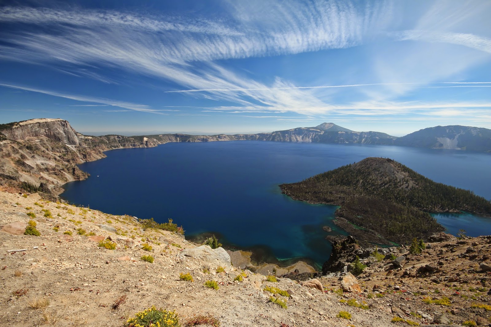
| A classic Crater Lake view with it's deep blue waters |
 |
| Twinkles relaxing in the Lodge |
On Thursday, we did the amazing 33 mile Crater Lake rim drive. It's a strange ride as the lowest point is 507 feet above the lake, the highest point is 1,978 feet and the average elevation of the Lake is 6,173 feet. This is the deepest Lake in the US at 1,943 feet at it's deepest spot and the 9th deepest Lake in the world. If you slip over the edge of the rim, it is almost a free fall to the lake surface hundreds of feet below.
We stopped at lots of pull offs for the views and did a couple of hiking trails. We hiked the Watchman Trail to a former fire lookout tower with great 360 degree views and then the Sun Notch Trail to a great view of the Phantom Rock.
At one roadside pull off as we stood by the stone wall a ground squirrel came charging over, very fast and aggressive, stood up on its hind legs staring at us, begging for food. I moved back as he seemed about to jump on me.
 |
| Begging for food |
Friday morning's visibility was poor due to smoke from the 790 forest fire that was drifting this way, but it seemed to clear as the day passed. It turned out to be a good hiking day for us, as we did three very pretty hikes. First was the Annie Creek rail right from the campground that went down into a canyon along Annie Creek with a lush green mossy meadow.
 |
A very special bird, the "Dipper", which will
go underwater to feed |
 |
| Annie Creek |
 |
| So many beautiful sights like this on the creek |
We then drove on the East Rim Road and the Pinnacles Road to the "Pinnacles". The Pinnacles are volcanic vents in which the ash was solidified into hard rock. The surrounding ash eventually eroded away leaving the hard rock pinnacles free standing as we see them today.
 |
| A small roadside waterfall along the rim drive |
 |
| A Pinnacles view |
 |
| The Pinnacles are extensive |
 |
| A beautiful tree wood grain |
Next was the Plaikni Falls Trail through an old growth forest to the waterfall. All three hikes in total were about 5 miles, but we are sucking wind at this 6-7,000 foot altitude as we have been near sea level the past few months.
 |
| The Plaikni Waterfall |
 |
| A up close look |
Saturday is again very hazy due to the forest fire smoke. I go for another hike on the Cleetwood Cove Trail which goes from the lake rim down to the lake level and the dock for the lake boat tour. It is a steep trail that descends 700 feet and is 2.2 miles round trip, a tough climb back up ! You get a totally different perspective of the lake from there and you can see that crustal clear water up close.
 |
| A hazy view from the trail |
 |
| Another dreamy view from the trail |
 |
| Looking down at a couple fishing in the clear water |
 |
| A view from the shoreline of the Lake |
 |
| Another perspective |
As we have no internet connection here, we had to go to the restaurant/gift shop where you can buy access at $4 per hour. We checked for RV parks in the Klamath Falls area where we are heading next. No reservations, but don't expect any problems, I hope !
In the evening I go back up to the Lake to take in the sunset views, the smokey haze is adding somewhat to the colors. Crater Lake has definitely lived up to all expectations.
 |
| Wizard Island view |
 |
| A jazzed up sunset view |
Next stop is Klamath Falls, Oregon;
Twinkles and Slick


No comments:
Post a Comment