March 21 - 27, 2017:
It is a simple trip on route 118 south for 80 miles to Study Butte, Texas. The road traffic was light, but the road was rock and Roll’in rough in places. The Chihuahuan Desert here is very desolate with far less vegetation as compared to the Sonoran Desert. In fact I couldn’t argue much with people who call it a barren wasteland. Approaching Terlingua there are many houses, really trailers, set in the desert with a ramada roof built over them for sun protection. There are also signs everywhere advertising land for sale, but it doesn’t look very appealing to me.
We have a reservation at the Big Bend Resort and Adventures in Study Butte which has a large RV campground. It is a full hookup site which will be good as it is going to be hot, high 90’s, AC will be needed. It is conveniently located 5 miles to Turlingua Ghost Town and to the Maverick Junction entrance of Big Bend National Park.
 |
It's a dry desolate parking lot, note the dead tree
in the center
|
It’s only March, but they are having a serious heat spell, the jeep outside air temperature is reading 99 degrees. We are happy to have a full hookup site and working AC. Alice has finally gotten used to the AC noise and is now kinda liking it. We are too !
Turlingua was a booming mining area in the early 1900’s, not for the usual gold, silver or copper, but instead for Quicksilver or Mercury. The Mercury was extracted from a mineral called Cinnabar that was discovered here in the 1880’s. It was in high demand in the early 1900’s and in particular during WWI by the military for munitions. At its peak about 2,000 hardy miners lived in Turlingua, mostly Mexicans. In 1942, the Chisos Mining Company went bankrupt, the mines closed and Turlingua soon became a ghost town. The alternate life style faction (hippies) of the 1960’s moved in and brought the town back to life. It remains an alternative life style haven with the economy now dependent on tourism and the Big Bend National Park.
The happening spot in Turlingua is the old Chisos Company Store which now sells tourist souvenirs, books, jewelry, etc. The thing to do is to sit on the outside porch, with a beverage of choice, gaze at the mountains, catch the sunset, contemplate the meaning of life and possibly discuss it all with one the locals who frequently are there. There is also the Starlight Theater attached which is a popular restaurant and music venue.
The Texas magazine describes it best
Four miles on, turn right at the sign for the Terlingua Ghost Town, where 2,000 people once walked the dusty streets. Now some 275 artists and other assorted desert rats and escapees from modern life live in trailers or the crumbling adobes of the long-gone miners. In truth, the individualistic and craggy locals mirror the terrain. The Terlingua Trading Company, at the end of the road, is a good place to meet some of them, as well as to buy local artifacts and beer and soft drinks. On any given weekend, you’ll find plenty of visitors at this gathering place, drinking beer, clanging horseshoes, inspecting the old cemetery, and just staring at the peculiar terrain. The jagged eastern horizon, with the mighty Chisos and Sierra Del Carmen mountains, looks like something out of a Flintstones cartoon; closer in are layered canyons, cracked limestone, old riverbeds, rugged outcroppings—it’s as if the earth couldn’t make up its mind what it wanted to be here. Desert? Mountains? Hills? Yes. Enjoy the confusion of Terlingua.
 |
The famous Terlingua company store
|
Our first outing in the National Park was on the rough gravel road, the Old Maverick Road, from the parks western gate at Maverick Junction to Santa Elena Canyon. It is 12.8 miles, very dusty and washboardy, crossing several rough washes and gullies. It is usually passable with a 2 wheel drive car when the road is dry, but by the looks of some of the ruts, it can be nasty at times.
We did a side trip to Terlingua Abajo which was definitely more suited to a high clearance jeep type vehicle. Terlingua Abajo was a farming community at one time, back when water still flowed year round in the adjacent Turlingua Creek which was lined with Cottonwood trees. Terlingua Abajo is just several adobe ruins now, the creek is mostly dry and the Cottonwoods are are long gone, that’s the price of progress.
 |
| Ruins of Terlingua Abajo |
 |
Old car at the nearby campground, there are several of
these wilderness campgrounds, that can be reserved, some
accessable for small RV's
|
The road passes the remains of “Luna’s jacal” which is a primitive house shelter. Gilberto Luna of Mexican and American Indian decent, lived here, raised a family and farmed the area for decades until his death in 1947 at the age of 108. That’s one tough man !
 |
| View on the Maverick Road |
 |
| View with the Santa Elena Canyon in the distance |
 |
| Luna's Jacal |
 |
View from inside, how would you like to live here, for
the rest of your life ?
|
Our destination, the Santa Elana Trail, is one of the most scenic attractions in the Park. The Rio Grande River has cut through the mountain creating a narrow gorge with almost vertical walls rising over 1,000 on both sides. The trail clings to the edge for about a half mile affording great views of the gorge. The Rio Grande River is the official boundary between Mexico and the US.
Next was a tour along the Ross Maxwell scenic drive to Castolan. We stopped and explored the ruins of the Sam Nail Ranch, one wall of melting adobe blocks is all that remains, but the windmill still is spinning. This was a self sufficient working ranch with cows, horses, chickens and they grew many vegetables and fruits. It was a very comfortable homestead in it’s day.
 |
All that's left of the ranch house
|
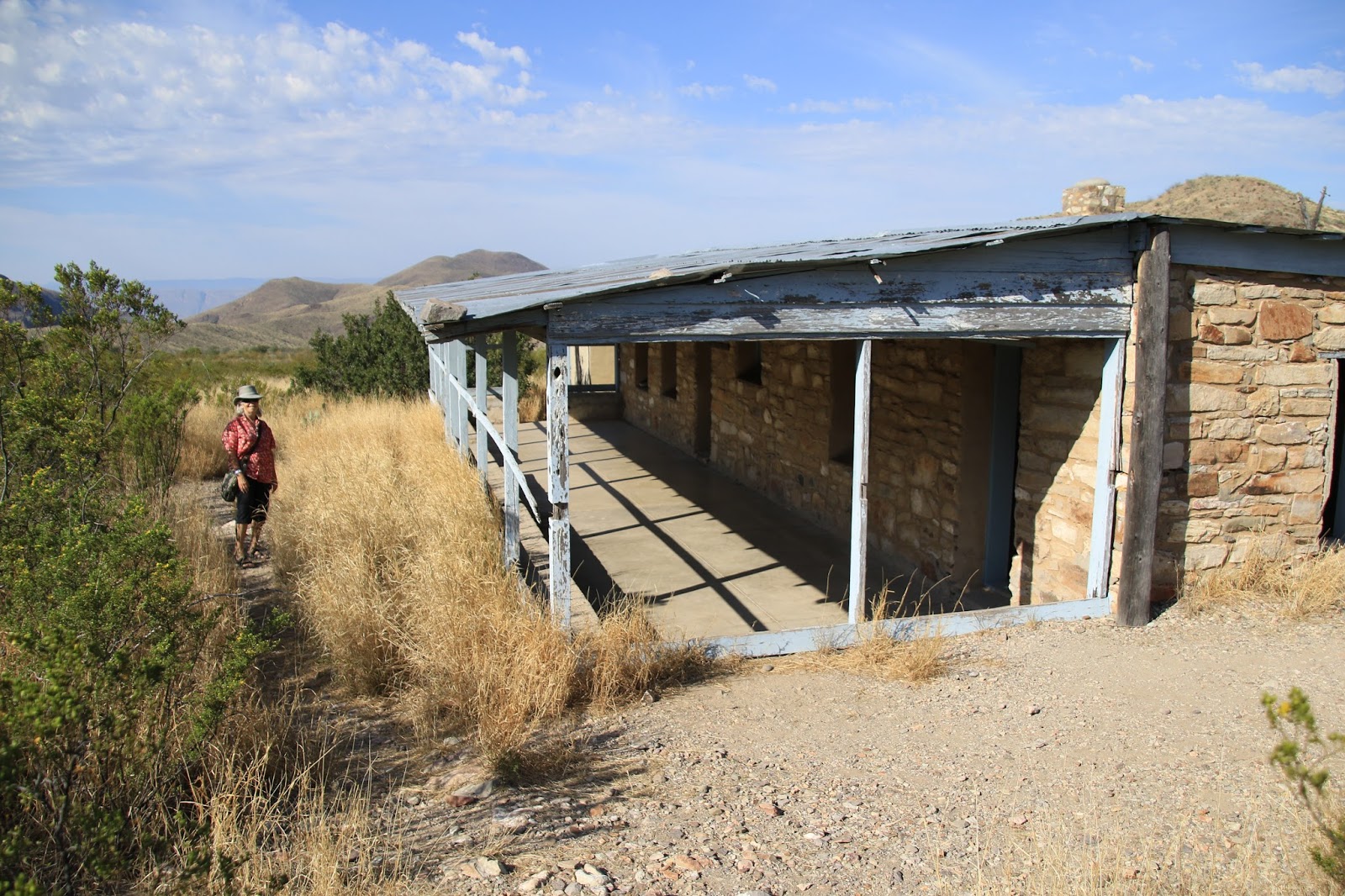
Another stop was at the Homer Wilson / Blue Creek Ranch site where we walked down about a 1/4 mile into the Blue Creek Canyon to the ranch house. It is a well constructed large rock house and was the center of the Homer Wilson ranching operations. They had elaborate water piping system from springs up in the canyon to cisterns and holding tanks on the ranch.
 |
| The Homer Wilson ranch house from the trailhead |
 |
| It's remains a nice big sturdy house |
 |
The Sheep dip
|
The highpoint of our day was a mile long walk into a box canyon to the Burro Mesa Pouroff. The views were incredible, although you might not want to be here during a heavy rain storm.
 |
| The impressive sight at the trailhead |
 |
| Perfect Yucca blooming in front |
 |
Twinkles standing at the bottom of the pouroff,
must be crazy when the water is dropping off
from the top
|
The Castolan visitors center is also most interesting and historical. The original building was initially a military barracks and then became a store and center of the La Harmonia Company. The La Harmonia Company started a successful Cotton growing operation in the fertile grounds adjacent to the Rio Grande River. The visitors center had lots of photos, history and information about the early settlers and farming operation. There also much on the border situation back in the 1900’s when it was mostly open and how it has changed in recent times.
 |
| The old La Harmonia Company store |
 |
| Cotton fields once extended from here to the river |
 |
Ocotilla view
|
We went to the Starlight Theater in Terlingua Ghost Town for dinner, not expecting anything really good. I did expect that it would have a rustic old west character to it and it delivered with its rough decaying adobe walls, original rough stone floor and painting of Poncho Villa over the bar. Surprisingly, the food turned out to be very good and they have live music often during diner time.
 |
| Inside the Starlight Theater |
 |
Our table with a painting of the Rio Grande
River
|
On Saturday night, we returned to the Starlight Theater for the live music to hear a touring blues player Eric Sommer. He was a weird character, perfect for Terlingua, who was a great blues slide guitar player and very entertaining. The porch outside was packed in the evening, but surprisingly, few of the porch people seemed to come inside the for the free music.
 |
Eric Sommer
|
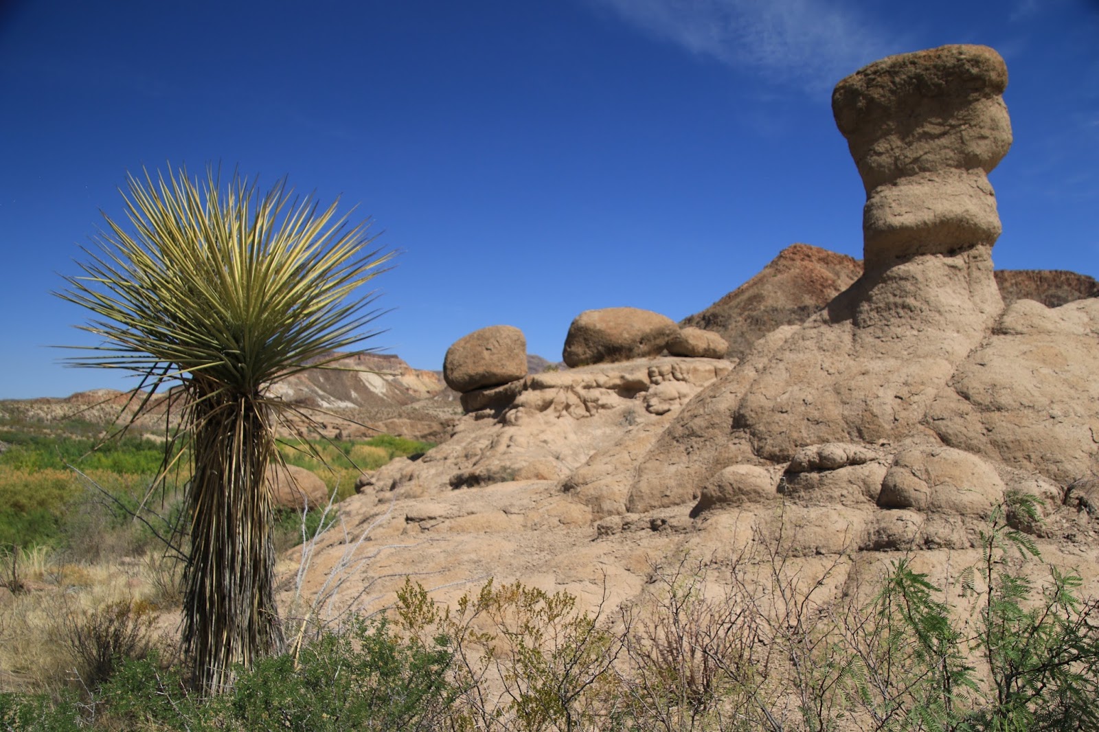
The Big Bend National Park is not the only game in town, the Big Bend Ranch State Park is down route 170 west about 20 miles. It is the largest State Park in Texas at 311,000 acres and runs for 23 miles along the Rio Grande River with many trails, picnic areas and campgrounds. It starts near the old town of Lajitas which is now an upscale golf resort and spa which the Terlingua locals hate, I tend to agree. Route 170 from Lajitas to Presideo is considered to be one of the most scenic drives in North America. It passes through mountainous terrain with many steep, curvy, roller coaster segments. We stopped for a couple of short but excellent hikes at the “Closed Canyon Trail” and the “Hoodoos Trail” The Rio Grande River is beautiful throughout this area as well, winding its way gracefully with lush green grasses, trees and sandy beach areas. Hopefully brighter minds will prevail and reject a stupid border fence in this area?
 |
| Heading west on route 170 |
 |
Great views along the route
|
 |
| Also great river views |
 |
| Hoodoos Trail view |
 |
| The Rio Grande River |
 |
Into the Closed Canyon
|
Next stop is the Rio Grande Village area on the east side of Big Bend National Park,
Twinkles and Slick


You are getting somewhat close to us. We are about 375 miles southeast of Big Bend State Park. I am so ready to start to move again, major hitch itch here. We head out again on the 20th.
ReplyDelete