June 19 - 23, 2020:
My first stop is the Old Silver Reef Mining Ghost Town where silver ore was discovered in limestone rock formations which was never found before and thought to be impossible. As usual it was a short lived by lucrative endeavor with a population of 2,000 in 1879. They have no way to process the silver at this site, they shipped it first by wagon, then the railroad from the Wells Fargo Express Station. All that is left today is the impressive old stone Wells Fargo Express Station converted now into a museum. There is also a reconstruction of the old Cosmopolitan restaurant, a few house foundations and the original jail. It originally had a mile long main street lined with all sorts of businesses. It now sits in the center of a fairly new affluent looking housing development. The museum was closed but there is a trail around the old town site with interpretive signs.
 |
| Wells Fargo Express Station |
 |
| Old foundation |
 |
| The original Jail |
Next was a speedy trip on route 15 north (80 MPH speed limit) I’ve noticed that everyone here drives really fast. The route takes through Hamilton’s Fort (Indian reservation area) and into the Dixie National Forest to the Old Iron Town Ruins. Mormon leader Brigham Young proclaimed that iron was needed and sent a group of dedicated followers to make it happen, he was the original "git it done" guy. Juniper wood (very plentiful) was to used for fuel to make charcoal for the iron making process. The original charcoal oven has been restored and is the centerpiece of the exhibit. There is a trail that takes you in view of the river where they obtained water for the forge via a wind driven pump and a canal that channeling water to the iron works building. There are foundations of a house and basically the foundation of the Iron Works, nothing to exciting except for the Juniper trees. I expect this area was denuded of Juniper back in the day, they used for everything, but they are back.
 |
| Charcoal oven |
 |
| House ruins |
I continue on to Cedar City, UT as my hoped for visit to Kolob Canyon north of Zion was scrubbed, it remains closed due to COVID-19. Arriving at Cedar City, Utah in late afternoon, it’s laundry time again, something I truly hate. I then scope out the Walmart reported to allow overnighters, looks very busy but will do fine.
On Saturday, I need to unwind a bit, getting a little stressed so I find my way to the historic downtown where there are a few almost vintage
building facades. There were a couple of amazing Mormon settlers immortalized in statue on Main Street, who have incredible stories. These people were true believers, on a mission and they achieved amazing things. This is a university town and the big attraction is their Shakespeare performance. I then found the Saturday farmers market where an elderly man had to comment on the tee shirt I was wearing and then said ; “Want to see my gun”, as he reached for a water pistol in a holster on his waist, possibly a little eccentric ? The egg woman then was interested in my camera.
 |
| The Cedar Theater |
 |
| Farmers Market |
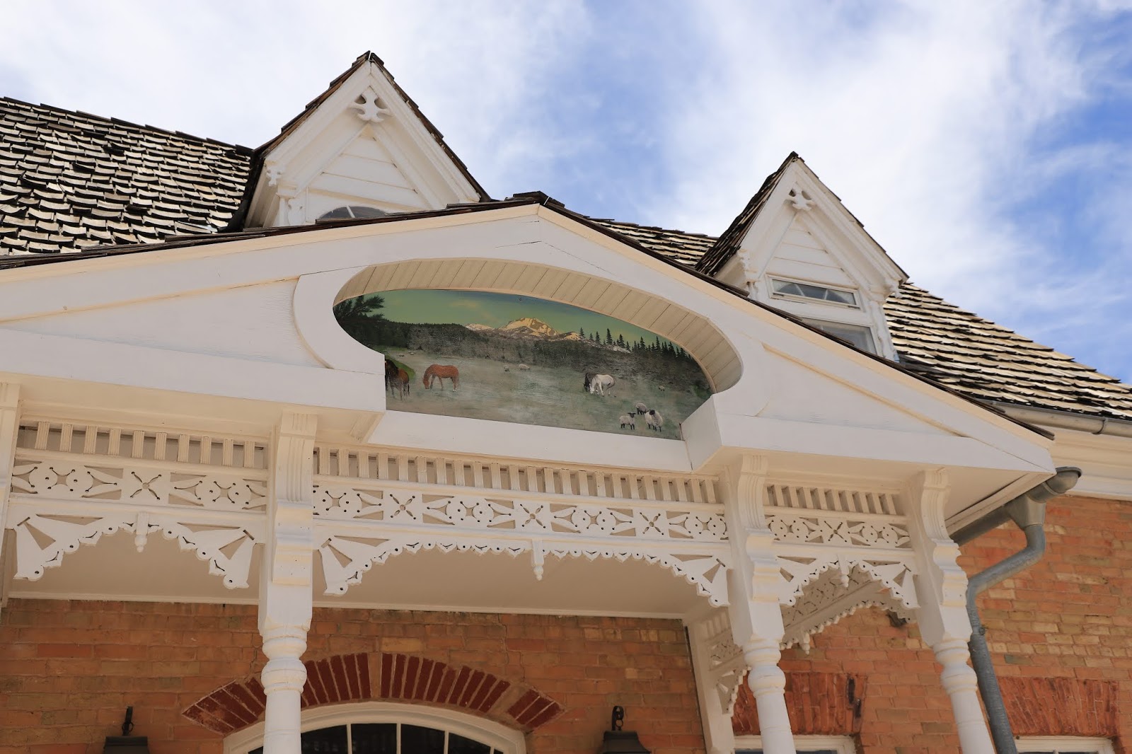
Next was a stop to the Frontier Homestead State Park State Museum which had lots of farm equipment, wagons of all kind and an impressive old house.
 |
| Wells Fargo Stage |
 |
| Homestead House with beautiful mural |
 |
| Huge shovel that was used a nearby mine |
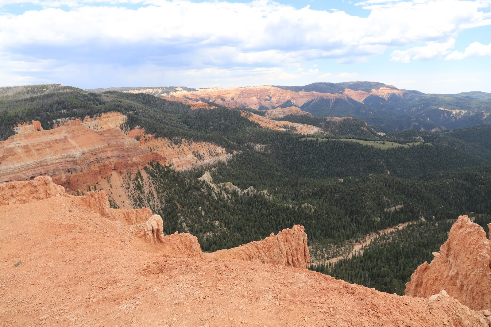
The real reason I”m here is to visit the Cedar Breaks National Monument. I find that there are two ways to get there, both involve very long steep roads.
The first trip up takes me through the Mormon pioneer town of Parawan, with everyone arriving for church dressed in their finest. The road then continues steeply uphill to “Brian Head” which is a major winter ski location, lots of development. Brian Head is actually the highest mountain peak in Utah at 11,300 ft. Its then a short distance to the north entrance to Cedar Breaks National Monument which borders the Dixie National Forest. There are several roadside overlooks and I stop at most, The sight looking down into the Monument is quite spectacular, similar to Bryce National Park. Eventually I make my way to the visitors center at the south end of the monument. I take the 2 mile Sunset Trail, paved trail that ends at the Sunset Point overlook. I then drive to the Chessman Ridge Overlook where I take the two mile Alpine Pond Trail. This trail was way more interesting especially the beautiful pond area. Snow is still piled in shaded spots along the upper section of the trail, we are talking over 10,000 ft elevation here, sub arctic temperate zone.
 |
| View on the Alpine Pond Trail |
 |
| The Alpine Pond is a beauty |
On the return trip to Cedar Break I take the alternate route, route route 14, which is equally steep and winding down through Cedar Canyon. There are amazing views along the way, but few places to pull off and rather heavy traffic. I’m back at Walmart for the night, not such a good view.
Day # 2 to Cedar Breaks takes me heading north up Rt 14 through Cedar Canyon route trying to find a couple of forest roads with potential camping sites for the night. The forest roads don’t seem to have signs and are hard to locate. I do spot a trailhead for the Bristlecone Pine Trail (1 mile) which is a nice short trail to a grove of ancient Bristlecone Pine Trees. These are amazing trees that can live for thousands of years. Back on the road, I eventually find a spot on forest road 277 close to Cedar Breaks that will do for the night.
Driving in on this route, Rt 14, brings you to the Cedar Breaks southern entrance and visitors center. The goal today is to hike the 4 mile Ramparts / Spectra Point Trail which starts at the visitors center. You have an option here to do only the Sprectra portion, 2 miles or the entire 4 mile loop. I go for the gusto, the whole enchilada as we say in Tucson. The trail is split equally between downhill and uphill, but it’s 10,000 ft altitude so it is a workout for the lungs, legs and eyes, the views are amazing ! The Bristlecone Pines at the upper areas are incredible !
 |
| Looking down into the ampitheater from the Ramparts Trail |
 |
| Another view, i'm not really that close to the edge |
 |
| A giant Bristlecone Pine |
 |
| These views all tend to look alike after a while, but you just can't stop taking them |
The forest road 277 campsite was in a wide open meadow with no one within sight. It will be chilly tonight, sleeping bag required. There is a hollowed out area nearby, sink hole perhaps, that still has a pile of snow. This meadow is beautiful, I’m treading lightly, lots of wildflowers are blooming, but the peak comes in July. The most abundant bloom currently seems to be the Aspen Blue Bells, they are everywhere. Oddly the common dandelion is growing wild all over this meadow. I’m still trying to get a handle on the trees, is that a fir, a spruce, a pine but they are all great, even the dead ones. The bark beetle ravaged this area a decade or so ago and it’s sad to see so many dead, but even the dead ones are beautiful. I wish I had Petey Mesquitey of (Growing Native on Tucson radio KXCI here to help with the botanical stuff.
 |
| A watery pond was near the campsite |
I travelled from Rt 148 to route 14 east to Duck Creek Village area where I found the Cascade Falls trailhead. It was a bit crowded, whenever a water fall is in the trail description everyone wants to see it, although this one wasn’t that inspiring to see. The way that this waterfall is created is the interesting part as it is just shooting out of a rock wall. This area has had much volcanic activity and the creek sort of goes underground upstream then flows through open lave tubes and exits at the edge of the rock formation.
 |
| Cascade Falls coming out of a Lave Tube |
I then traveled upstream along Rt 14 to to Navajo Lake which is a large water recreational area. The extensive lava flows in this area blocked the creek which created the current lake. As you drive on Rt 14 through this area lava flows are evident on the sides of the road for miles and the road is actually built across them in several places. I stopped at the Lake Rim Trail and did a short walk to view the lava flow area adjacent to the lake.
 |
| Navajo Lake is an oasis |
 |
| The Lave flow and the contrasting green of the Aspens was beautiful |
Lastly, I returned to Cedar Breaks on Rt 143 and travelled back to Brian Head where I went in search of the Twisted Forest Trail. I had no clear directions, but using the road name and a fake street number my GPS lead the way. It involved several dusty, steep back roads, almost wilderness areas. I was about to give it up when a sign appeared for the trail. Another rough two miles and I was at the Twisted Tree trailhead. I was thinking, this better be good, I’m not sure how to find my back to the highway. This turned out to be a great trail, although steeply uphill, 10,000 ft elevation, but this ancient forest of Bristlecone Pine trees on a barren alpine slope were a sight to see. At trails end you come to a cliff edge and a wide panorama view of colorful Cedar Breaks landscape.
 |
| The twisted shapes are like works of art |
 |
| The end of the trail is really the end |
I am getting a motel room for the night, I need to get rid of some of this dust, then I'll be heading northwest towards Nevada.


No comments:
Post a Comment