August 7 - 8, 2020 - Bigfork to Kalispell and Eureka, Montana
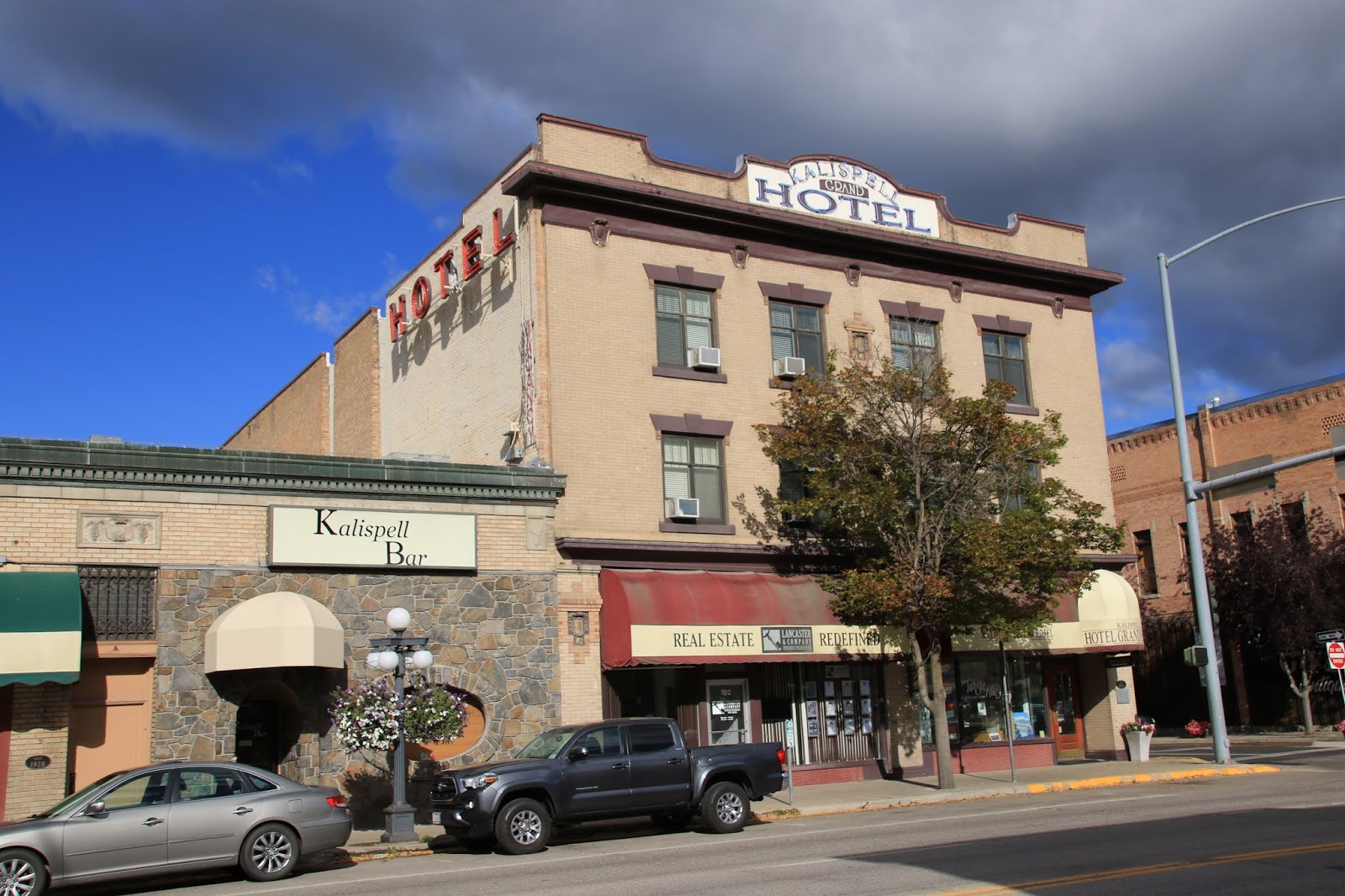
It’s only about 30 miles from Bigfork to Kalispell driving on route 93 north. I had been to Kalispell some years ago and it comes back to me after driving down Main Street. Main Street has many historic buildings occupied by a nice selection shops and businesses. I do my usual walking tour of Main Street, talking a few photos, noticing a very attractive bakery, but relent for now. I see the old Carnegie Library, now the Hockaday Art Museum and surprisingly it is open. I go in and find a photo exhibit that is interesting, a few Great Northern Railroad advertising art pieces and the rest was closed in preparation for an upcoming show. The high point was the gift shop where all their posters were half off and a Great Northern Indian promotional poster became mine.
I passed the excellent museum in the old school building across the street, but I remember visiting it on my previous visit and I’m kind of OD’d on museums right now.
 |
| The Courthouse is a beauty |
 |
| The former Kalispell Hotel |
I head out in the morning on route 2 west passing a bike trail that runs for several miles along the former Great Northern train line. I then come upon a series of beautiful lakes, McGregor and Thompson along the road, stopping at Thompson for a couple of photos.
 |
| Roadside view |
 |
| The reflections of the clouds and the trees in Thompson Lake were great |
The highway then runs parallel to Libby Creek to the town of Libby where it joins the Kootenai River. Route 2 goes right through Libby and the Heritage Museum which was closed but they leave their outside lot open allowing you to wander around which I do.
https://en.wikipedia.org/wiki/Libby,_Montana
 |
| A well done Texaco gas station exhibit |
 |
This photo is in many guide books, it's known as Paul Bunyan's Fry Pan that was used
to cook with at Libby's annual Logger Day's festivals |
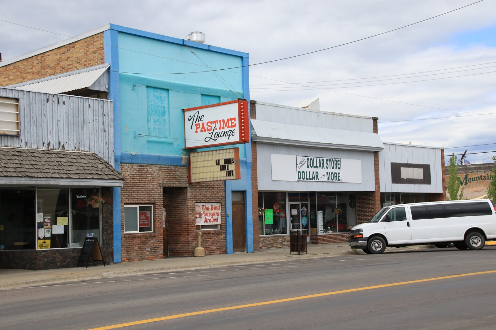
Libby is the county seat of Lincoln County Montana and is the largest area town. It had a short lived mining boom, then timber became the big industry, now I suppose it’s tourism. The historic downtown is looking a little rough, the usual thing, all the new business are located in the newer section of town on route 2. It’s Saturday, most of the downtown businesses are closed and the sidewalks are empty. The Libby Hotel, probably Libby’s finest years ago now looks more like a welfare Hotel. I stop at the visitors Center, it’s closed, but there is a map that I look at to see exactly where the Kootenai Falls are located.
 |
| Casino's and wood saws are big in Libby |
 |
| The Pastime Lounge and Dollar Store |
 |
| Appropriate mural for Libby |
 |
| Empty storefront ? |
 |
| The old Hotel Libby looking shabby these days |
I continue on route 2 about 18 miles to the Kootenai Falls where the parking lot is nearly full. It’s a popular easy trail to the waterfall and the popular river suspension bridge. There was a line at the bridge, barely moving so I headed for the waterfall instead. It’s funny how everyone wants a thrill ride or some form of adventure these days, but the bridge isn’t a big deal. The water fall by itself wasn’t that special either, I’ve seen many much larger ones, but the overall view of the river rapids, the swift current and the series of falls all combined make for a great view.
 |
It wasn't' cute, it was stupid; They carried this dog all around
getting the maximum attention possible |
 |
| The Kootenai River |
 |
| The bridge was the top attraction for most tourists |
Following that I drove another 28 miles on route 56 to the Ross Cedar Grove which is a grove of giant Western Red Cedar Trees that are very old and massive. They can live for about a thousand years. I don’t understand exactly how or why these trees escaped the woodsman’s saw. There is a loop nature trail that was very good with many interpretive signs. After leaving heading back on route 56
I came upon a roomy roadside pull off next to the beautiful Bull Lake that was a good scenic overnight camping site for me.
 |
| Not giant redwoods, but very impressive |
 |
| These two seem to have merged together |
 |
| There was a couple with a cute daughter who kept pushing over the cairns, they kept telling her to stop, she just kept doing it, until they finally took her away, she was an evil child ! |
I was woken at 5 AM by a pickup truck pulling in next to me, about the time I start to wake when I go to sleep by 10 PM. They only stayed a few minutes and left, probably a bathroom stop, but I was ready for trouble with my bear spray in hand. I get an early start thinking I will stop in the next town to get a coffee and then make breakfast, a bowl of cereal.
 |
| I did get a decent sunrise photo in the morning |
Troy Montana is the place where I get a coffee in a gas / convenance store. As I drank the coffee, I kept thinking of the really dirty hands of the store clerk who probably made the coffee. On the highway, my first impression was that this is a crappy place, except for the nice museum and visitor’s center, but on getting off the highway, I find that the rest of the town is rather nice. At the old downtown, near the railroad tracks, you find an historic old log two story bar that has been restored, (but overdone) with fancy carved wooden posts and a wooden motorcycle sculpture on the facade. This is the original Main Street and there are a few other old nice surviving buildings in line on the street. There are signs that tell of the glory days when Troy was a railroad Division Point, that employed hundreds of workers, had a large turntable, a large engine house and miles of storage tracks. It’s all gone now, the old timers, the locomotives and the buildings, but the signage tells the story. The railroad shop was eventually eliminated with the switch to Diesel Locomotives which was a huge crushing blow for the town. The other boom industry was lumber, it’s not as great now as it was back in the day when billions of railroad ties were needed and everything was made of wood. This is Trump country, I suppose they hope Trump will make it mandatory to make everything out of wood and bring back the steam locomotives.
 |
| The impressive Troy school building with its gladiator monument |
 |
| The Biker Bar, the entire building is made of logs |
 |
| The old Kootenai Valley State Bank |
 |
| A very well equipped Roosevelt Park |
 |
| The Lincoln Theater |
 |
| A touching story about the town Christmas Tree |
 |
| The Christmas Tree is a big one |
I stop at Yaak Falls next to the highway where you need to carefully go down a slippery slope to get close to the waters. The trees were so dark and the water so white due to the lighting condition that the photo is terrible. Another less than great waterfall, but an overall great view.
 |
| Yaak Falls |
So, I’m continuing on route 2 heading north through densely forested country, but lots of mailboxes on the road, the houses are hidden back from the road, there are way more people and houses here than are seen. Of course the further north I go the thiner that gets and then I arrive at the town of Yaak. I hesitate to call it a town, all I could see was a two biker bars with a small store and one gas pump. I took a photo, they were interesting, but I did expect a little more.
 |
| This could be true for many |
 |
| The Dirty Shame Saloon in Yaak |
The road is slowly climbing higher and higher and has gotten more narrow and the views of the distant mountains are great. The Forest is so green and the trees so tall, I don’t think I’ve seen so much lush greenery. We then start downhill in a steep, curvy descent for miles and then come out in view of the Koocanusa Reservoir. This is a beautiful sight and huge, the waters are backed up from the Libby Dam, near the town of Libby far away. I cross the impressive bridge to the opposite shore and head for the town of Rexford. I stop there and don’t really see much of a town at all, just a large campground. In the residential area, I even see several open sided, shelters with class A RV’s parked inside, set on regular residential lots. I latter find out that the original townsite was swallowed up by the reservoir and replaced by this rather strange campground looking town.
 |
| The road was very narrow |
 |
| The view between the trees was great ! |
 |
| A recent burn area that is now covered with wildflowers |
 |
| The reservoir and bridge were a sight ! |


No comments:
Post a Comment