April 26 - May 1, 2016;
I am tired of saying it, but it’s another mind boggling, beautiful ride from Death Valley to Lone Pine, California. You go from the lowest point in the country to within sight of the highest point in the country. We stop at an excellent BLM information Center coming into Lone Pine for local maps and information. They recommend the Tuttle BLM campground about 4 miles away which is dry camping, with a dump station and potable water spigots for 2.50 per day with our senior card. The snow covered Sierra Nevada Mountains are right in front of us with 14,494 foot Mt. Whitney in plain view. Mt. Whitney is the highest mountain in the continental US and also the most hiked mountain peak in the US as it is only 10 -11 miles from the trailhead, albeit some very hard miles miles going from 8,000 - 14,000 + elevation.
 |
Fantastic views from the road
|
 |
Great campground view as well
|
Lone Pine is a very scenic small town with several restaurants, shops, services and an amazing movie museum. We visited the Museum of Western Film History which has great exhibits on the early western movies and movie stars. This town must have been a very exciting place to be when these movies were being shot. The movie business dropped off considerably after the demise of the classic westerns, but there is still considerable activity here as the scenery remains spectacular. The downtown has character with a couple of great old business signs, always a favorite of mine.
 |
Downtown Lone Pine
|
 |
Best food in town
|
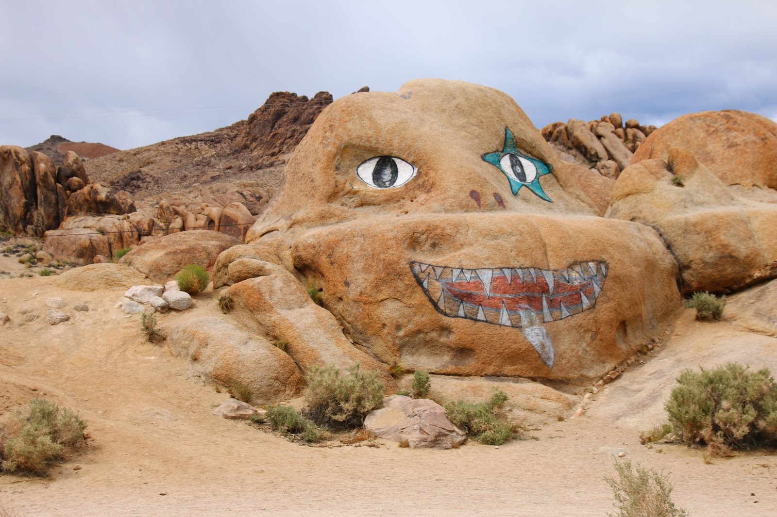
The Alabama Hills are within sight of our campground where since 1920 over 400 Western and a few Sci-Fi movies have been filmed in Movie Flat. Movie road runs through it with side roads and trails all over and it is also a great camping / boondocking spot. The terrain is a mass of jumbled rocks and towering rock formations. It requires some scouting and is limited for a large RV, but a small rig can fit about anywhere. The first couple of miles of Movie Road offer the best prospects and the road is better.
We took a short loop hike to the Mobius Arch, very scenic every direction. We then tried to locate the Lone Ranger Canyon, we think we found it, but there seems to be no sign or monument. As the story goes, this is where he was ambushed as a Ranger, left for dead, then found and saved by trusted sidekick Tonto, and then took up wearing the mask and fighting evil doers. Hopalong Cassidy did more movies here than anyone else and he also has an “ambush rock” area. The more famous stars seem to have specific areas associated with them for filming.
 |
Driving into the Alabama Hills on Movie Road
|
The weather has been crazy here, very windy with alternating periods of sun and dark clouds, it’s always raining somewhere in the distance, but we seem to be in the rain shadow of the mountains at the campground. The Mountain views here in every direction are something I don’t think I could ever get used to, they are so immense, so wild and so majestic. The upper elevations appear to have picked up more snow in the last couple of days.
 |
Rain is coming !
|
We were planning to leave here on Friday April 29th until we called the campground and found that it is booked solid due to the start of fishing season. As a result, we extended here. Those damn fishing people ! They even caught the two trout Twinkles had been watching in Tuttle Creek behind our campsite for the past two days.
The present local economy is all tourism but in past times it was mainly the mining of various minerals in the Owens Valley lake, the salt flats, the surrounding mountains and ranching. A narrow gauge railroad, the Carson and Colorado Railroad, was formed in 1880 which ran through the valley connecting the towns and mines. It became known as the “Slim Princess”. The line stopped running in 1960 and Engine No 18, built by Baldwin Locomotive, was saved and is currently undergoing restoration in the town of Independence.
We took a ride south to look at the Cottonwood Charcoal Ovens that were originally used to make charcoal for the mines on the opposite side of the lake. We then rode along the old shoreline of Owens Lake, which is now a huge project to restore the original lake habitat and control dust. This Lake was bought in the early 1900's by Los Angeles and the river water was diverted to feed the city of Los Angeles. The once verdant green valley then went dry and a dust bowl developed. They are now pumping water back in, a semblance of a lake has formed again and it has become a haven for birds. They are also re planting vegetation and taking other actions for dust control.
 |
Cottonwood Charcoal Ovens
|
 |
View of Owens Valley showing some green again
|
Next stop is Bishop, California;
Twinkles and Slick


Love this! What a beautiful, informative travelogue! Thank you.
ReplyDelete