Delta to Montrose, Ridgway, Ouray and Silverton, Colorado :
September 16-17, 2010:
I depart Delta, Colorado traveling on route 550 south. It is mostly farming country with several fruit and vegetable stands along the road. It is also famous for its sweet corn and has an annual corn festival. I exit for a brief tour of the town of Olathe and to my surprise find that the old historic downtown area is almost totally poor Spanish businesses catering to the farm workers. Political immigration issues have hurt local farmers ability to plant and harvest their crops, see attached link.
https://coloradosun.com/2020/07/14/olathe-sweet-corn-king-soopers-john-harold/
https://en.wikipedia.org/wiki/Olathe,_Colorado
 |
| Didn't expect to see a potato growers co-op here |
 |
| Get your beef here |
 |
| Lighten up people ! |
 |
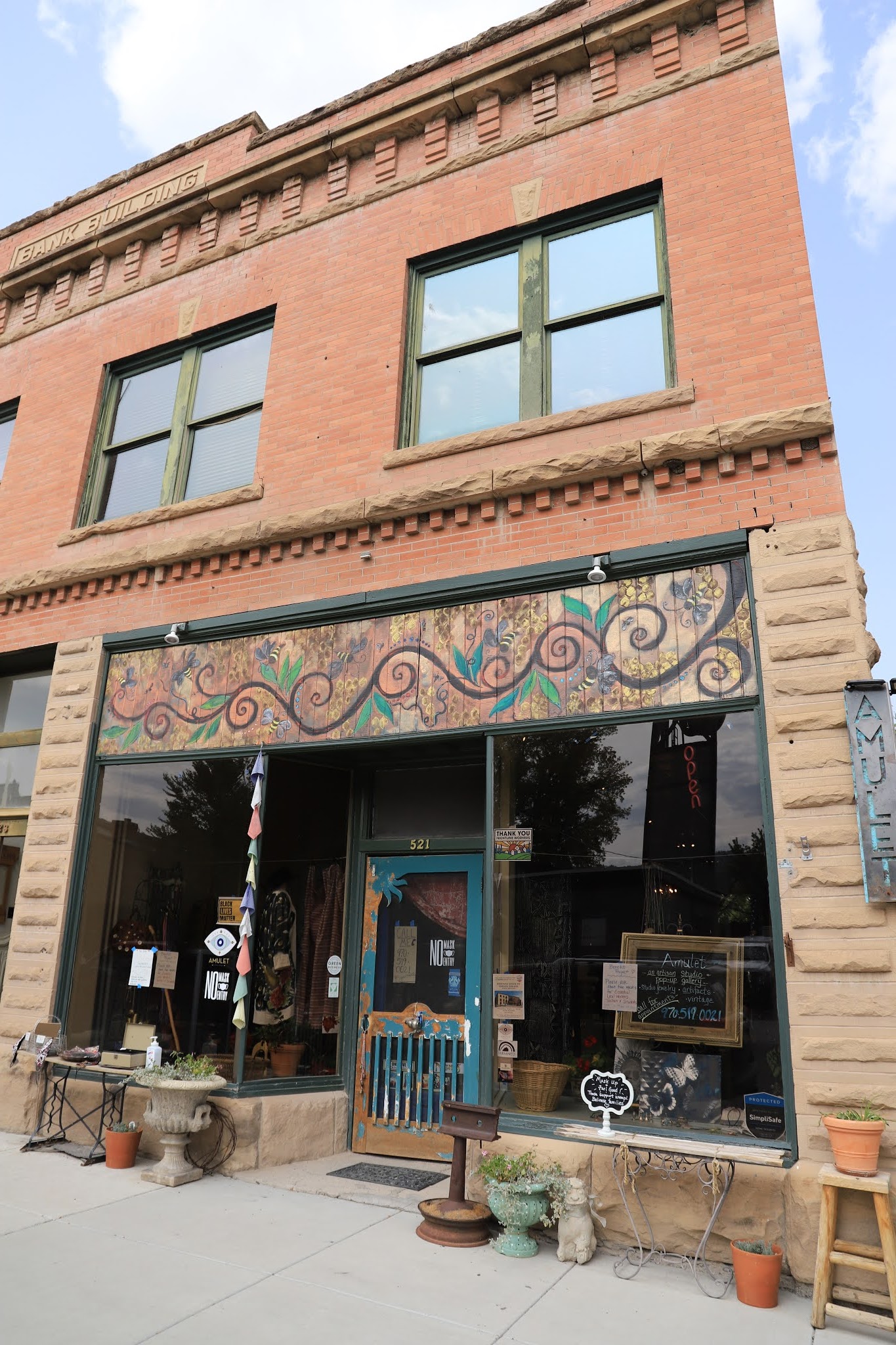
| The former Bank building |
 |
| Like the sign on this very poor looking roof |
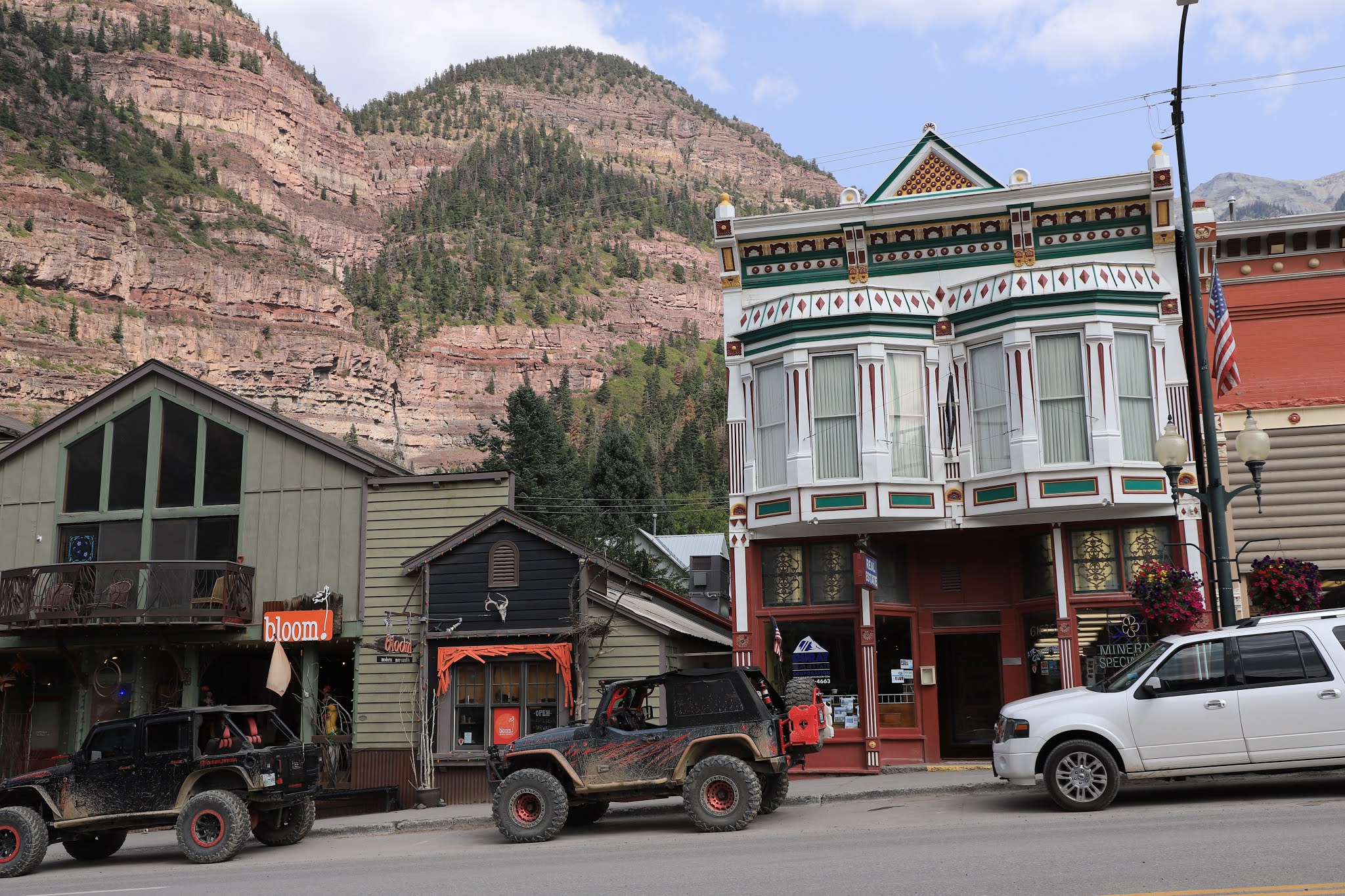
The next stop is Montrose, Colorado where I park and walk several blocks. There is a beautiful City Hall, a nostalgic old movie theater, several nice restored buildings and an eclectic mix of shops, restaurants, cafes and bars. I buy a couple of goodies at a bakery, then a pair of socks at another store and painfully bypass a couple of antique shops. Also see a good looking museum housed in the old train depot and the "Work Horse Building", now a brew pub. I like this town and could easily spend more time here.
https://en.wikipedia.org/wiki/Montrose,_Colorado
 |
| The Denver and Rio Grande Depot is beautiful and now houses a museum |
 |
| The Work Horse building, now Rascals 2 brewery |
 |
| Book store and Market / Bistro - all good |
 |
| My kind of Town Hall |
 |
| I find these shops filled with lots of cool stuff |
 |
| Uncompahgre County is an "Incomparable Valley with the unpronounceable name" |
 |
| The Fox Theater |
 |
| Perhaps the best visitors center sign depicting the nearby Black Canyon of the Gunnison |
 |
| Montrose City Hall is beautiful |
The southern entrance of the Black Canyon of the Gunnison National Park is only about 15 miles outside of Montrose. There was no one at the entrance gate and no charge to get into the park, but the South Rim Road and all parking pullouts and trails were open. There is a small visitor’s Center, but it was closed, except for a very limited store operation.
The canyons name comes from the fact that parts of the gorge only get 33 minutes of sunlight a day. Several canyons in the west are longer or deeper, but none combines the depth, sheerness, narrowness, darkness of the Black Canyon.
I drove the South Rim Road and stopped at most of the roadside pullouts, some of which are just viewpoints while others have trails of varying lengths. The air quality was not great, there was considerable haze, possibly smoke, obscuring the views somewhat. It seemed to improve latter in the afternoon. I also thought about going to the north rim of the park, but It is a long circuitous trip to get there from here.
https://en.wikipedia.org/wiki/Black_Canyon_of_the_Gunnison_National_Park
https://www.nps.gov/blca/index.htm
 |
| The south rim drive is mostly looking down into dark canyons |
 |
| You can barely see the Gunnison River far below |
 |
| The lighter designs in the rocks called Pegmatite Dikes, they were formed by molten rock being squeezed into fissures forming light-colored bands in the dark canyon walls |
 |
| It is possible to hike to the river only as a guided hike with a special permit |
I return to Montrose afterwards, do some laundry and go to a brewery / pizzeria for dinner. I locate the West Main Trailhead for the River Walk Trail in Montrose that has a few overnight RV parking spots. Well maybe, When I get out of the van in the morning there was a ”No overnight camping’” sign directly in front of the van. There were a few vehicles in and out during the night, this seems to be a local hang out spot. I went on a short walk on the River Trail in the morning, it is fairly new looking, paved in the short area I walked, mainly a trail for bikes, runners and causal hikers, but a very nice trail that goes for many miles. I latter find that this is an ambitious city wide recreational development plan called Colorado outdoors, see below.
https://coloradooutdoors.co/interactive-site-plan/
 |
| A beautiful river trail along the Uncompahgre River |
 |
| I love the pure white of the milkweed seeds and what an incredible design |
I stopped at the Ute Indian Museum on the way out of town, I’ve been there before or at least walked around the grounds. It is an excellent museum that appears to be affiliated with the Ute tribe. Their story is another painful one, the chief recognized by the US, Chief Ouray, recognized early on that the Ute Tribe could not win against the invading masses and attempted to live in unison with the whites. Several treaties were agreed to, but each failed and with each new treaty, the Ute’s land was further reduced and eventually the Ute’s were forced entirely off their native land.
https://www.historycolorado.org/ute-indian-museum
 |
| Good communication skills helps |
 |
| An authentic beaded buckskin shirt of Chief Ouray |
 |
| Chief Ourays wife Chipita was an equally remarkable woman |
 |
| This was her saddle and saddle blanket |
 |
| Buckskin Charlie took over as chief after Ouray |
 |
| Chief Ouray |
 |
| A man of peace in a time of great change |
 |
A nearby RV park with the notorious Hanging Tree where George Bikford was
hung for robbery and horse theft in 1878 |
 |
| The Spanish Dominquez-Escalante Expedition came through this area in 1776 |
It was almost noon when I left the museum heading on route 550 south to Ridgway, Colorado. Ridgway is another beautiful small town that I remember seeing in the past. It has many attractive restored early 1900’s buildings now housing artsy craft shops, antique shops, cafes, restaurants, outdoors equipment and bike shops. It also has a nice grassy park in the center of town. This is another town I could spend more time in.
https://en.wikipedia.org/wiki/Ridgway,_Colorado
 |
| Lots of arts and crafts here |
 |
| Several good murals around town |
 |
| Not sure what this is all about |
 |
| Mountain Girl Gallery |
 |
| Love the cut out figure |
 |
| An interesting poem |
 |
| Another great mural under repair |
On the outskirts of town is the home to the Galloping Goose Railroad. They have Galloping Goose # 1, a replica of the original, along with Galloping Goose #4 and several historic old coaches and freight cars on display.
 |
| They have a short loop track here to give rides |
 |
| Galloping Goose # 1 which started as a 1931 Buick 4 door sedan, this is a replica built in 2000 |
 |
| Latter versions were built from truck / bus components and about anything else available |
 |
| Rio Grande Southern No 4 |
 |
| How can you not love the galloping Goose ? |
I then continued on route 550 south to Ouray, Colorado, a most interesting old mining town in a beautiful mountain setting. At it's peak there were some 30 active silver and gold mines in the area. The entire downtown is registered as a National Historic District. I made a few passes along the streets lined with interesting shops, old hotels, bars and restaurants. The town was crowded with tourists, everyone adhering to the face mask requirement.
https://en.wikipedia.org/wiki/Ouray,_Colorado
 |
| Hotel with amazing backdrop |
 |
| Western hotel |
 |
| Duckett's Market is it in Ouray |
 |
| The old Elks Club building |
 |
| At the top is this wonderful carved figure |
 |
| The Walsh Library building set against the mountain |
 |
| Mr. Grumpy Pants Brewery |
 |
| Chief Ouray Trading Post |
I could have easily overnighted on a side street, but went to explore a dispersed camping site several miles up in the nearby hills, liked it there and stayed.
 |
| A quiet secluded campsite |
In the morning, I had hoped to go to this bakery in downtown Ouray, but when I arrived at it there was a line outside as they were only letting one person in at a time. I didn’t need my bakery fix that bad and went instead to a nearby motel store instead.
On my way out of town, I went to the Box Canyon Falls on the outskirts of Ouray which I soon realized I had gone to on a previous visit. There really isn’t much of a waterfall to see as it's is mostly hidden behind the canyon walls. This is really a slot canyon and the walkway leading into the canyon and the stairs taking you down to the river are the real attraction.
 |
| The walkway |
 |
| You then come to a stairway which takes you down to the river |
 |
| During high water periods, the river appears comes up to the walkway |
I then head south on route 550 known as the “Million Dollar Highway” amidst fairly heavy traffic, lots of campers are on the road and since it’s a Friday there are the weekend warriors as well. These rig’s are getting more ridiculous all the time, campers pulling trailers with multiple ATV’s on them. This area is prime Jeep and ATV country, there are many primitive back roads that are perfect for them.
It was quite cloudy and hazy for the first part of the journey, but it gradually cleared and was almost blue sky by the time I arrived in Silverton. I looked into a couple of forest campgrounds shown on the Ultimate Campgrounds website, but saw no advantage in using them. It's much easier for me to overnight on a street in town and the campground scene generally annoys me anyhow.
 |
| This mountain streams' water is tainted by mine tailings |
 |
| Another tainted River view |
 |
| Remains of Larson Brothers mine |
 |
| This will be going on for many years |
 |
| View form an overlook |
 |
| By 1883 40 silver mines were operating in this area |
 |
| View from an overlook |
 |
| Red Mountain Pass at 11,018 foot elevation |
Approaching Silverton, the fall foliage starts to get incredible, the Aspen Trees are near peak coloration and beautiful. I exit the highway just before town for a historic site, the mine workers memorial which overlooks the Silverton.
 |
| Worth a stop |
 |
| Or two |
 |
| I take a short detour on a side road for this spectacular view |
Driving down Main Street I quickly see that Silverton gives the ATV crowd free reign to drive around the town, it’s good for business, but sure ruins the quiet and serenity of the town. It seems a little out of control in my opinion even though there is a large board of rules for them entering town.
https://en.wikipedia.org/wiki/Silverton,_Colorado
 |
| They are lined up along the streets |
I do a few laps around town checking the sights, bringing back memories of an earlier visit, it is a beautiful downtown set in an amazing valley surrounded by mountains. The residential areas of Silverton are very rustic, some of the houses are from the mining boom days. I can’t help but wonder, how have they managed to keep the developers out ? How much longer can this beauty last, until they start building the condos and townhouses and the high end urban sprawl begins.
 |
The mining memorial on hilltop overlooking Silverton
|
 |
| The Stater Hotel is beautiful |
 |
| Grand Imperial Hotel from the side |
 |
| Grand Imperial Hotel signs and bar were great |
 |
| Lots of tourists on the streets |
 |
| City Hall |
 |
| View down Green Street |
 |
| Old Arcade Trading Company |
 |
| Natalia's Restaurant was closed |
 |
| The Shady Lady had an outdoor seating area set up |
 |
| Old Rio Grande freight car |
It’s Saturday morning as I drive about 8 miles south on route 550 to the forest road leading to the Little Mora Lake campground and a trailhead for the Colorado Trail. It’s a about a six mile trail going moderately uphill for about 850 feet elevation gain. The Colorado Trail runs for 483 miles from Durango to Denver and this area is mostly out in the open along a ridge top affording great mountain views in all directions. This trail is a favorite of the mountain bike crowd, many passed me along the trail. I also passed a cowboy on horseback leading a string of horses on the trail. There are hundreds of trails in this area, good for all ability levels. Also many trails for the Jeep and OHV enthusiasts.
 |
| Great views on this high open trail |
 |
| Lush vegetation in this area |
 |
| The well worn trail ahead, I feel like I'm on an old Indian Trail |
 |
| There are several large dead trees remaining |
 |
| I pass a cowboy heading a string of pack horses on the trail |
 |
| I'm on a high open ridgeline |
 |
| A view of Little Mora Lake a mile from the trailhead |
I plan on leaving Silverton in the morning for Durango, Colorado and probably my final week of this trip. After Durango I am debating which routes to take back to Tucson, trying to avoid the same route I took last year, even if it is the most direct.
Next stop is Durango, Colorado


No comments:
Post a Comment