Durango, CO to Gallup, NM to Springerville, Arizona;
September 21-22 , 2020:
I take route 160 to route 550 to Aztec, New Mexico and then route 516 to Farmington where I stop to take a ride on Main Street. It was painful to ride through Aztec without stopping at the incredible Aztec Ruins National Monument, but I've seen it a few times and I need to keep moving. I've also been to Farmington, but decide to at least check out Main Street. Much to my surprise they are completely redoing Main Street, an ambitious project involving a complete renewal of the street, the utilities, curbing, sidewalks, and landscaping. It should be beautiful when completed.
https://en.wikipedia.org/wiki/Farmington,_New_Mexico
 |
| The streets of Farmington was being totally redone |
 |
| A very ambitious plan |
 |
| I like the way they did it with rounded flowing corners, very nice |
 |
| Another downtown view |
 |
| Happy Days at the Three River Tap and Game Room |
 |
| Several nice historic buildings in Farmington |
I then take route 64 west through the Navajo Reservation to Shiprock where I take route 491 south to Gallup, New Mexico. They are also redoing route 491 and it needs it very badly. The road is like a roller coaster in places, I hit one bump, more like a jump, where I believe all four wheels of the van were off the roadway for an instant.
 |
| Interesting mural in Shiprock, NM |
 |
| Navajo Covid-19 sign |
 |
| I love these old Highway bridges |
 |
| A view of Shiprock from route 491 |
It started to rain intermittently on route 491 with some gusty wind, but nothing serious became of it. I headed straight to the Red Rocks State Park outside of Gallup in hopes that the weather would clear and I could take a hike to Church Rock. It looked promising briefly, then the dark clouds rolled back in.
I then head to the downtown Gallup, NM which I always find very interesting. It’s a beautiful, colorful downtown with much public art work, murals and signs on virtually every block and corner. Also tons of Navajo jewelry, beads, rugs and art work. You will have poor Indian street people approaching you for money, most are polite and harmless, but probably not a good place to wander around alone at night.
https://en.wikipedia.org/wiki/Gallup,_New_Mexico
 |
| I thought the sign was funny but equally sad |
 |
| There is a vibrant arts scene in Gallup |
 |
| A long train mural is appropriate |
 |
| Very artistic trash receptacles |
 |
| Street construction in Gallup in front of beautiful Navajo rug mural |
 |
There is a series of patriotic murals around town, I thought this one
was especially good |
 |
| This is half of the mural showing the coming of the railroad in Gallup |
 |
| The other half of the mural showing the ancestral puebloan culture |
 |
| McKinley Court House built in 1938-39 |
 |
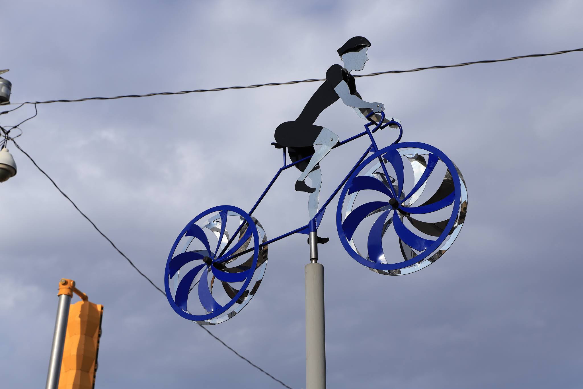
| Great bicycle sculpture |
 |
| Many great Navajo shops in town |
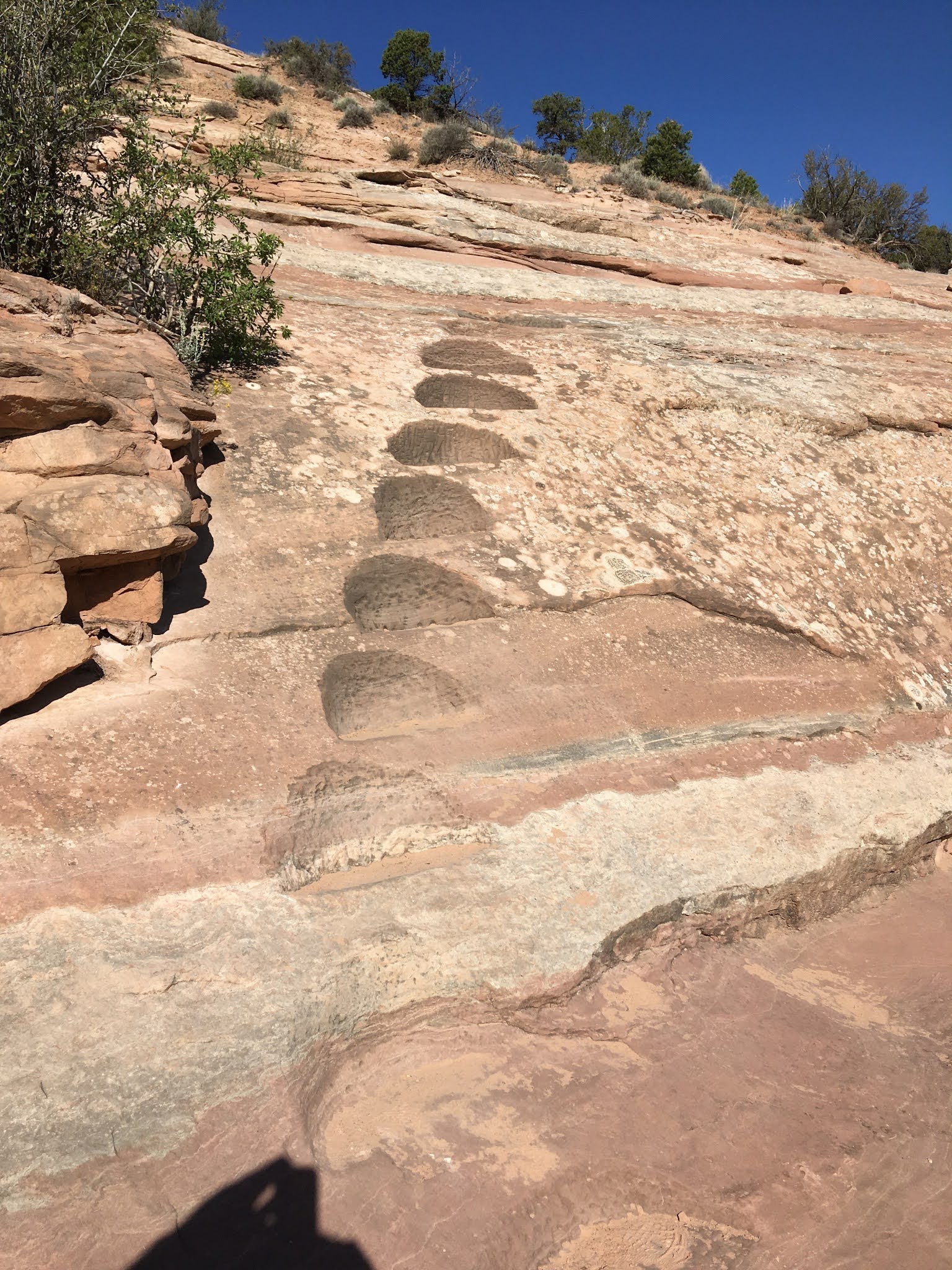
In the morning under bright sunny conditions I return to Red Rock State Park where I hike the Church Rock loop Trail. This is a great trail of moderate difficulty with great views, well marked with rock cairns and steps cut into the rock on steep inclines. Also great wildflowers and weeds (I love the weeds equally) in the wash coming down from Church Rock.
 |
| The Navajo tribe has a great convention center, museum, rodeo arena and campground here |
 |
| Wildflowers were blooming especially well |
 |
| Carvings in the rock, some old, some new |
 |
| The sandstone here is beautifully colored, textured and shaped |
 |
| Someone went to extremes in cutting these steps in the trail |
 |
| Getting closer to Church Rock |
 |
The trail seemed to disappear about here, but I remember getting closer to the top
on a previous hike |
 |
| Layers of sand hardened to stone over the millennia |
On completing this hike, I get on the road heading for Eagar, Arizona taking a more direct, but slower route on country roads. I take route 602 south to route 53 west, but then come upon a sign saying that the road will close ahead with only resident Zuni tribe members allowed access through. I am disappointed, I had hoped to see more of Zuni, but not surprised as the Indian tribes take these viruses very seriously as they should. The landscape views in this area are exceptionally beautiful.
 |
| I just had to pull over for this view |
 |
| There were several stops |
So I turn around, and take route 36 south to Fence Lake which looks like a place frozen in time with many old log cabins, a few trailers, a small community center, but no store or gas station in sight. I then continue on Route 36 south to Quemado, New Mexico. This entire route 36 has been about as desolate and remote as anywhere I’ve driven, no travel services, no towns or houses. It is mainly all cattle ranches and range land with just the big ranch sign on the roadway. Quemado has the look and feel of an old Mexican settlement, but I find little evidence of that. It was settled in 1880 by Jose Antonio Padilla who brought sheep in and started a sheep raising industry. The Sacred Heart Catholic Church appears old but the parish was started in 1952, although the graveyard looks really ancient. The town is small but at least it has a gas station and a store. I then turn onto route 60 west towards Eagar, Arizona.
https://en.wikipedia.org/wiki/Quemado,_New_Mexico
 |
| About 100 miles of this |
 |
| Definitely a Spanish feel here |
 |
| The Sacred Heart Church |
 |
| Pioneer graveyard |
 |
| Downtown Quemado, NM |
On my road map Eagar was in bold type while Springerville was not, making me think that Eagar was the prominent area town, but all road signs listed the next town as Springerville, confusing me a bit. Route 60 took me into Springerville first and I was impressed, there was a small historic area, a museum, several motels and restaurants, even a McDonalds. As I pass the Casa Malpais Museum, I see a sign about tour registration and find that there is a daily tour at 9 AM of the pueblo ruins and that no self guided touring is allowed. I sign up for the pueblo tour and then tour the museum. The museum is great with very interesting local history, well done exhibits and recovered articles from the Casa Malpais ruins.
 |
| Coronado Expedition mural on a wall outside the museum building |
 |
| Springerville was a terminus of the the Coronado Trail |
 |
| Chief Alchesay was a prominent leader |
 |
The original stage curtain from the Apache Theater, now the El Rio Theater, built in 1913. It is
the oldest movie theater in Arizona. |
 |
| Why have we not heard of Perry Owens before ? |
 |
| A colorful wild west character |
 |
| An artist depiction of Casa Malpais |
 |
| A bowl recovered for room 14 |
 |
| Other objects recovered set before an artistic rendering of a pueblo room interior |
I then take a walking tour of Springerville, it's a small downtown area, nothing very exciting, but clean and wholesome. A very notable thing about Springerville is that the Springerville volcanic field contains over 400 volcanoes within a 50 mile radius making it the 3rd largest volcanic field in the continental United States. Springerville was established in 1879 as Henry Springer's Trading Post.
 |
| The Springerville welcome sign |
 |
| A couple of the Springerville's empty historic buildings |
 |
The famous Madonna of the trail statue installed in 1928, there were 12
of them installed at various western locations |
 |
| Nearby is another memorial to the 1950's car |
 |
The El Paso Theater originally called the Apache Theater was built in 1913 and is
the oldest theater in Arizona. The original construction is adobe and plank. |
I then take a short ride to Eagar. It is separate town but directly connected to Springerville. It has a small shopping center and a small downtown area but doesn't have the tourist amenities, motels and restaurants like Springerville. What it does have however is quite remarkable and possibly ridiculous. The Eagan high school football stadium, the "Round Valley Enshere" is the 8th largest geodesic dome in the world ???!!!!
In the morning I do the Casa Malpais tour with a group of six other seniors, all educated tourists with similar interests. The tour guide was excellent, made it as interesting as possible and was full of information.
This is a unique pueblo as it was built on five volcanic terraces. It was inhabited by the Mogollon people from 1260 to 1400 and then deserted. There is a unusually large Kiva which suggests that this was an important site. Also there is a solar calendars used to aid crop planting using celestial events. Only a few rooms have been excavated, but many artifacts were uncovered from them. The remaining rooms, by agreement with area indigenous tribes are to be left undisturbed. The Hopi and Zuni tribes consider this a sacred place.
https://en.wikipedia.org/wiki/Casa_Malpa%C3%ADs
 |
| I don't know why, but this sign indicates different occupation dates ? |
 |
| The tour heading uphill into ruins |
 |
| Looking down at an area that appears to have been a cleared field for crops |
 |
There are a few petroglyphs in the rocks
|
 |
| A partial view of the Kiva from ground level |
 |
| A view of the large Kiva from above |
 |
| It is far easier to visualize the pueblo compound from above |
 |
| The view at ground level |
 |
| A couple of rooms with reconstructed walls |
After the tour, I'm off at noon for either Wilcox or Safford, Arizona.


No comments:
Post a Comment